- Usage in publication:
-
- Beaver Brook Member*
- Modifications:
-
- Original reference
- Dominant lithology:
-
- Gneiss
- Amphibolite
- Schist
- AAPG geologic province:
-
- New England province
Summary:
Pg. 184-185, 208, App. 1 (in pocket). Beaver Brook Member of Nashoba Formation. Medium-gray sillimanitic biotite gneiss, amphibolite, schist, and calc-silicate rocks. Medium-grained, stratified, relict sedimentary structure. Thickness 1,580 m. Is uppermost member of the Nashoba. Overlies Long Pond Gneiss Member (new) of Nashoba Formation; underlies Tadmuck Brook Schist (new). Age is pre-Silurian.
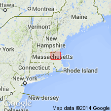
Type locality: area bounded on northeast by Mill Road, on southeast by Foster Street in town of Littleton, on southwest by Old Turnpike-Littleton County Road in towns of Boxborough and Harvard, and on northwest by southeast foot of Oak Hill in towns of Harvard and Littleton, Middlesex Co., central MA; Ayer, Hudson, and Westford quadrangles, Middlesex Co., central MA. Origin of name not stated.
Source: US geologic names lexicon (USGS Bull. 1520, p. 9-10).

- Usage in publication:
-
- Beaver Brook Member*
- Modifications:
-
- Age modified
- AAPG geologic province:
-
- New England province
Summary:
Age of Nashoba Formation changed from pre-Silurian to Proterozoic or Ordovician.
Source: GNU records (USGS DDS-6; Reston GNULEX).
For more information, please contact Nancy Stamm, Geologic Names Committee Secretary.
Asterisk (*) indicates published by U.S. Geological Survey authors.
"No current usage" (†) implies that a name has been abandoned or has fallen into disuse. Former usage and, if known, replacement name given in parentheses ( ).
Slash (/) indicates name conflicts with nomenclatural guidelines (CSN, 1933; ACSN, 1961, 1970; NACSN, 1983, 2005, 2021). May be explained within brackets ([ ]).

