

- Usage in publication:
-
- Beaver Bay group*
- Modifications:
-
- Original reference
- Dominant lithology:
-
- Gabbro
- Diabase
- AAPG geologic province:
-
- Sioux uplift
Summary:
Pl. 14, p. 143-146. Beaver Bay group. Characterized by predominance of black, coarse-grained, olivine-bearing gabbro in very heavy layers without amygdaloids, and by great abundance and prominence of included red felsitic porphyries and granite-like rocks, also considerable thickness of fine-grained diabases with amygdaloids, with and without amygdaloids, and some ordinary fine-grained diabases with amygdaloids. Thickness 4,000 to 6,000 feet. Underlies Temperance River group and overlies Agate Bay group, all included in the Keweenaw series. Age is pre-Cambrian (Keweenaw).
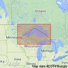
Exposed on Beaver Bay, northeastern MN.
Source: US geologic names lexicon (USGS Bull. 895, p. 138).

- Usage in publication:
-
- Beaver Bay Complex*
- Modifications:
-
- Overview
- AAPG geologic province:
-
- Lake Superior region
Summary:
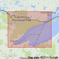
Present in Duluth area of northeast MN in Lake Superior region. Mapped with Duluth Complex and includes mafic plutonic rocks that intrude volcanic rocks of the North Shore Volcanic Group. Is Middle Proterozoic in age.
Source: GNU records (USGS DDS-6; Reston GNULEX).
- Usage in publication:
-
- Beaver Bay Complex*
- Modifications:
-
- Geochronologic dating
- AAPG geologic province:
-
- Lake Superior region
Summary:
High precision U-Pb dates on zircons and baddellyites from two hypabyssal bodies yielded ages of 1096.1 +/-0.8 Ma (Sonju Lake intrusion) and 1095.8 +/-1.2 Ma (gabbro at Silver Bay). Beaver Bay is slightly younger than Duluth Complex (ll07 to 1099 Ma). Study area is within Midcontinent Rift system, Lake Superior region. Generalized geologic map (fig. 1); correlation chart with absolute ages (fig. 2).
Source: GNU records (USGS DDS-6; Denver GNULEX).
For more information, please contact Nancy Stamm, Geologic Names Committee Secretary.
Asterisk (*) indicates published by U.S. Geological Survey authors.
"No current usage" (†) implies that a name has been abandoned or has fallen into disuse. Former usage and, if known, replacement name given in parentheses ( ).
Slash (/) indicates name conflicts with nomenclatural guidelines (CSN, 1933; ACSN, 1961, 1970; NACSN, 1983, 2005, 2021). May be explained within brackets ([ ]).