

- Usage in publication:
-
- Beaufort formation*
- Modifications:
-
- Original reference
- Dominant lithology:
-
- Sand
- Glauconite
- Limestone
- AAPG geologic province:
-
- Atlantic Coast basin
Summary:
Pg. 8 (table 4), 12-13, 29-30, 37-38, 45, 51-52, 64, 71. Beaufort formation. Variable composition, ranging from green glauconite sands containing about 90 percent glauconite to gray argillaceous sands containing about 5 percent glauconite; indurated shell-limestone intercalations common; euhedral pyrite is common accessory mineral; fossiliferous. Type well penetrated 65 feet of Paleocene strata between depths of 150 and 215 feet. Well logs show formation underlies Castle Hayne limestone or Yorktown formation, or locally, an unnamed middle(?) Miocene unit; overlies Upper Cretaceous Peedee formation. Age is Paleocene (Midway).
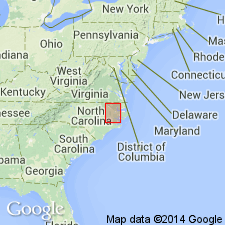
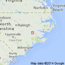
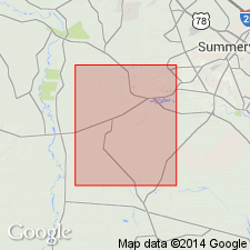
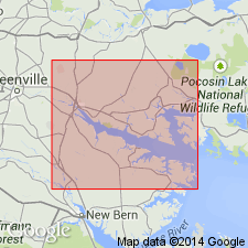
["Type section"] (subsurface): well 215 ft deep, drilled in 1952 for Nelson Motel, Chicowinity, Beaufort Co., eastern NC. Recognized in wells in Martin, Bertie, Hertford, Gates, and Chowan Cos., eastern NC.
Source: US geologic names lexicon (USGS Bull. 1200, p. 255-256).
- Usage in publication:
-
- Beaufort Formation*
- Modifications:
-
- Revised
- AAPG geologic province:
-
- Atlantic Coast basin
Summary:
Jericho Run Member named and assigned to base of Beaufort Formation in Graingers area, Lenoir Co., NC. Beaufort now known to crop out. All previous information has been subsurface. Jericho Run is described as black to gray siliceous mudstone with basal conglomerate and chert and sandstone layers. Member ranges from 0.9 to 2.7 m. Type locality of new member is on Jericho Run, a tributary to Neuse River, where it is exposed in a ravine.
Source: GNU records (USGS DDS-6; Reston GNULEX).
- Usage in publication:
-
- Beaufort Formation*
- Modifications:
-
- Areal extent
- AAPG geologic province:
-
- Atlantic Coast basin
Summary:
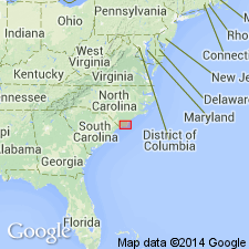
Unit is tentatively extended into subsurface of eastern SC. Age is Paleocene.
Source: GNU records (USGS DDS-6; Reston GNULEX).
- Usage in publication:
-
- Beaufort Formation
- Modifications:
-
- Areal extent
- Biostratigraphic dating
- Overview
- AAPG geologic province:
-
- Atlantic Coast basin
Summary:
An outlier of Beaufort Formation occurs in the southeast corner of the study area. In cores this unit is a gray argillaceous siltstone to fine-grained sandstone with traces of glauconite, mica, or pyrite. Beaufort is discontinuous throughout the study area. Several cores near BW-P-5-69, where the Beaufort is 20 ft thick, contain no Paleocene strata. One contains only an 8-in section, which has been correlated with the Beaufort. Unit is easily identified because it occurs between a zone of phosphorite mineralization at the top of the Peedee Formation and a zone of phosphorite pebble conglomerate at the base of the Castle Hayne, both with distinctive gamma ray signatures. A sample from corehole BW-P-5-69 contains MOROZOVELLA PSEUDOBULLOIDES and GLOBOCONUSA DAUBJERGENSIS, the latter of which occurs only in planktic Zone P1 (Danian). Strata from Pender Co. just to the north contain both Thanetian and Danian foraminiferal assemblages.
Source: GNU records (USGS DDS-6; Reston GNULEX).
- Usage in publication:
-
- Beaufort Formation
- Modifications:
-
- Revised
- AAPG geologic province:
-
- Atlantic Coast basin
Summary:
Beaufort Formation in the Albemarle embayment consists of the lower Jericho Run Member and the upper Moseley Creek Member, formally named in this report. These two members are recognized in outliers in the upper part of the middle Coastal Plain and are separated from the main body of Paleocene strata that occurs in the subsurface in the outer part of the Coastal Plain. In outcrop, the Beaufort reaches only 26 m in thickness, while in the subsurface it is nearly 100 m thick. The two members represent two depositional sequences separated by an unconformity. The Jericho Run has been assigned to the planktonic foraminiferal zones P1 and P2 (Danian) and the Moseley Creek to zone P4 (Thanetian).
Source: GNU records (USGS DDS-6; Reston GNULEX).
- Usage in publication:
-
- Beaufort Formation*
- Modifications:
-
- Overview
- AAPG geologic province:
-
- Atlantic Coast basin
Summary:
Paleocene Beaufort Formation occurs at the base of the Cenozoic section. Contains a siliceous mudstone (Jericho Run Member) overlain by a glauconitic sandstone (unnamed upper member). Beaufort is best exposed near Kinston, NC, where it overlies the Cretaceous Peedee Formation. Here the boundary is marked by a phosphate-pebble conglomerate developed during the Paleocene transition. Unconformably underlies middle Eocene Castle Hayne Formation.
Source: GNU records (USGS DDS-6; Reston GNULEX).
For more information, please contact Nancy Stamm, Geologic Names Committee Secretary.
Asterisk (*) indicates published by U.S. Geological Survey authors.
"No current usage" (†) implies that a name has been abandoned or has fallen into disuse. Former usage and, if known, replacement name given in parentheses ( ).
Slash (/) indicates name conflicts with nomenclatural guidelines (CSN, 1933; ACSN, 1961, 1970; NACSN, 1983, 2005, 2021). May be explained within brackets ([ ]).