The National Geologic Map Database is migrating to a new infrastructure. We apologize for any service disruptions during this process.
|
|---|


- Usage in publication:
-
- Beaucoup Formation*
- Modifications:
-
- Named
- Biostratigraphic dating
- Dominant lithology:
-
- Siltstone
- Limestone
- AAPG geologic province:
-
- Alaska Northern region
Summary:
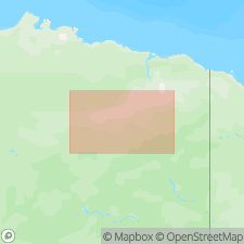
Type measured section on northeastern side of Beaucoup Creek, secs.19 and 20 T14S R20E, Philip Smith Mountains A-1 quad, central Brooks Range, AK. Consists of black, brown, yellowish-brown assorted clastic and carbonate rocks including reefs and reefoid layers which are thin- to medium-bedded, fine- to very fine-grained, and fossiliferous. Unconformably overlies Skagit Limestone; conformably underlies Hunt Fork Shale. Age is Late Devonian, probably early Frasnian on basis of corals and brachiopods.
Source: GNU records (USGS DDS-6; Menlo GNULEX).

- Usage in publication:
-
- Beaucoup Formation
- Modifications:
-
- Biostratigraphic dating
- AAPG geologic province:
-
- Alaska Northern region
Summary:
Shown on geologic sketch map of Chandalar D-6 and parts of Chandalar C-6 and D-1 quads as of Middle and Late Devonian age. Fossils identified by A.G. Harris and J.T. Dutro, Jr. Localities of fossils shown on sketch map. "Along strike and across Dietrich River Valley conodonts indicative of a short interval that straddling[!] the Middle-Late Devonian boundary were found in marble layers in black phyllite of the Beaucoup Formation." p.344.
Source: GNU records (USGS DDS-6; Menlo GNULEX).
For more information, please contact Nancy Stamm, Geologic Names Committee Secretary.
Asterisk (*) indicates published by U.S. Geological Survey authors.
"No current usage" (†) implies that a name has been abandoned or has fallen into disuse. Former usage and, if known, replacement name given in parentheses ( ).
Slash (/) indicates name conflicts with nomenclatural guidelines (CSN, 1933; ACSN, 1961, 1970; NACSN, 1983, 2005, 2021). May be explained within brackets ([ ]).