- Usage in publication:
-
- Beatty Wash Formation*
- Modifications:
-
- Named
- Dominant lithology:
-
- Rhyolite
- AAPG geologic province:
-
- Great Basin province
Summary:
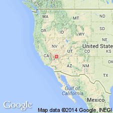
Named as largest and most significant unit of volcanics of Fortymile Canyon, an informal assemblage within southwest Nevada volcanic field. Type area is upper reaches of Beatty Wash, for which unit is named, Topopah Spring NW quad, Nye Co, NV, Great Basin province. Consists of rhyolite lava domes and related pyroclastic rocks deposited in moat of Ammonia Tanks caldera; also includes related tuff of Cutoff Road on west side of Timber Mountain caldera complex adjoining Oasis Valley. Formerly referred to as rhyolite of Beatty Wash. Volcanics of Fortymile Canyon consist of rocks deposited above Ammonia Tanks Tuff and related lavas of Timber Mountain Group (rank raised for both units) and beneath peralkaline units of Thirsty Canyon Group (rank raised). Volcanics of Fortymile Canyon include widely dispersed units referred to as rhyolite of Rainbow Mountain in Beatty area, rhyolite of West Cat Canyon to west of Timber Mountain, and mafic lavas at Dome Mountain and rhyolite lavas of Shoshone Mountain along southeast margin of Timber Mountain caldera complex. Nomenclature chart (table 1). Assigned Miocene age based on 40Ar/39Ar age dates on underlying and overlying units.
Source: GNU records (USGS DDS-6; Denver GNULEX).
For more information, please contact Nancy Stamm, Geologic Names Committee Secretary.
Asterisk (*) indicates published by U.S. Geological Survey authors.
"No current usage" (†) implies that a name has been abandoned or has fallen into disuse. Former usage and, if known, replacement name given in parentheses ( ).
Slash (/) indicates name conflicts with nomenclatural guidelines (CSN, 1933; ACSN, 1961, 1970; NACSN, 1983, 2005, 2021). May be explained within brackets ([ ]).

