The National Geologic Map Database is migrating to a new infrastructure. We apologize for any service disruptions during this process.
|
|---|


- Usage in publication:
-
- Beattie formation
- Modifications:
-
- Original reference
- Dominant lithology:
-
- Limestone
- Shale
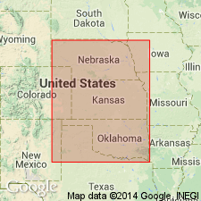
- AAPG geologic province:
-
- Forest City basin
- Nemaha anticline
- Cherokee basin
Summary:
Pg. 13. Beattie formation. In section on West Branch Creek, NW/4 sec. 10, T. 1 N., R. 10 E., 3.5 miles south and 7 miles west of Pawnee City, Pawnee County, southeastern Nebraska, it consists of (descending): Morrill limestone, 1 foot; Florena shale, 3 feet; and Cottonwood limestone, 11.5 feet. The Kansas Geological Survey is to group the Morrill, Florena, and Cottonwood as Beattie formation; type locality, Beattie, Marshall County, northeastern Kansas. The Nebraska Survey concurs. Report includes measured sections.
Source: US geologic names lexicon (USGS Bull. 896, p. 135-136); supplemental information from GNU records (USGS DDS-6; Denver GNULEX).

- Usage in publication:
-
- Beattie limestone formation
- Modifications:
-
- Overview
- AAPG geologic province:
-
- Forest City basin
Summary:
Pg. 7. Beattie limestone formation of Council Grove group. Followed classification of Condra and Busby (1933), as did R.C. Moore (1936, Kansas Geol. Survey Bull. 22). Includes Morrill limestone, Florena shale, and Cottonwood limestone. Thickness 18 feet. Overlies Eskridge shale formation; underlies Stearns shale formation (both of Council Grove group). Age is Permian (Big Blue).
Source: US geologic names lexicon (USGS Bull. 896, p. 136); GNC KS-NE Permian Corr. Chart, Oct. 1936.

- Usage in publication:
-
- Beattie limestone
- Modifications:
-
- Overview
Summary:
Pg. 46-47. Beattie limestone. Includes (ascending) Cottonwood limestone, Florena shale, and Morrill members. Thickness 15 to 25 feet. Underlies Stearns shale; overlies Eskridge shale. Age is Early Permian (Wolfcamp).
Source: US geologic names lexicon (USGS Bull. 1200, p. 216).

- Usage in publication:
-
- Beattie Limestone
- Modifications:
-
- Overview
Summary:
(Paleozoic Era; Permian System by H.G. O'Connor, D.E. Zeller, C.K. Bayne, J.M Jewett, and Ada Swineford, p. 46-47.) Beattie Limestone of Council Grove Group. In Kansas includes (ascending) Cottonwood Limestone Member, Florena Shale Member, and Morrill Limestone Member. Thickness about 10 to 25 feet. Overlies Eskridge Shale and underlies Stearns Shale, both of Council Grove Group. Age is Early Permian; Gearyan Provincial Stage (of H.G. O'Connor, 1963, AAPG Bull., v. 47, p. 1873-1877).
Source: Publication.
- Usage in publication:
-
- Beattie Limestone
- Modifications:
-
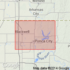
- Areal extent
- AAPG geologic province:
-
- Chautauqua platform
Summary:
Beattie Limestone of Council Grove Group. Thickness 20 to 30 feet. Includes (ascending) Cottonwood Limestone (5 to 10 feet thick), Florena Shale, and Morrill Limestone Members. Florena and Morrill are equivalent to basal "Whitney sand zone" (informal). Age is Early Permian.
Detailed descriptions from 10 coreholes, 4 reference-log wells, and 1 measured surface section, in Kay County, north-central Oklahoma. Cores catalogued and stored at Oklahoma Geol. Survey's Core Library in Norman, Oklahoma.
Source: Publication.
For more information, please contact Nancy Stamm, Geologic Names Committee Secretary.
Asterisk (*) indicates published by U.S. Geological Survey authors.
"No current usage" (†) implies that a name has been abandoned or has fallen into disuse. Former usage and, if known, replacement name given in parentheses ( ).
Slash (/) indicates name conflicts with nomenclatural guidelines (CSN, 1933; ACSN, 1961, 1970; NACSN, 1983, 2005, 2021). May be explained within brackets ([ ]).