The National Geologic Map Database is migrating to a new infrastructure. We apologize for any service disruptions during this process.
|
|---|


- Usage in publication:
-
- Bear Pond limestone member
- Modifications:
-
- Original reference
- Dominant lithology:
-
- Limestone
- AAPG geologic province:
-
- New England province
Summary:
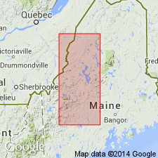
Pg. 7, 8, map. Bear Pond limestone member of Seboomook formation. Blue gray on fresh surfaces and gray on weathered surfaces; contains subrounded to subangular granite pebbles up to 2 inches across; fragments of brachiopods, corals, and crinoid stems; angular black calcite crystals or fragments up to coarse sand size; brown and white mica flakes; some pyrite and other iron-sulfide crystals. Observed only at one outcrop where it is 10 feet stratigraphically above a slate exposure; neither top nor bottom of unit exposed. Thickness about 10 feet. Age is Early Devonian.
Exposed in northwest corner T. 3, R. 5, in area west of Beck Pond and Bear Pond, Spencer [Spencer Lake] 15-min quadrangle, Somerset Co., west-central ME. Named from Bear Pond.
Source: US geologic names lexicon (USGS Bull. 1200, p. 251-252); GNU records (USGS DDS-6; Reston GNULEX).
For more information, please contact Nancy Stamm, Geologic Names Committee Secretary.
Asterisk (*) indicates published by U.S. Geological Survey authors.
"No current usage" (†) implies that a name has been abandoned or has fallen into disuse. Former usage and, if known, replacement name given in parentheses ( ).
Slash (/) indicates name conflicts with nomenclatural guidelines (CSN, 1933; ACSN, 1961, 1970; NACSN, 1983, 2005, 2021). May be explained within brackets ([ ]).