

- Usage in publication:
-
- Bear Pond schist
- Modifications:
-
- Original reference
- Dominant lithology:
-
- Schist
- AAPG geologic province:
-
- Adirondack uplift
Summary:
Bear Pond schist. A feldspar quartz-graphite schist, included in Grenville series. Is older than Beech Mountain amphibolite and younger than Catamount schist. Thickness 30+/- feet. Age is pre-Cambrian.
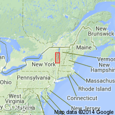
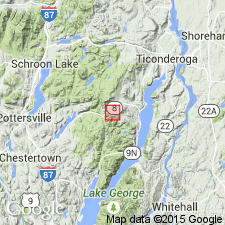
Type locality: Bear Pond, Ticonderoga Twp., Essex Co., Adirondacks, northern NY.
Source: US geologic names lexicon (USGS Bull. 896, p. 133).
- Usage in publication:
-
- Bear Pond schist
- Modifications:
-
- Areal extent
- AAPG geologic province:
-
- Adirondack uplift
Summary:
Pg. 289 (fig. 28), 290. Bear Pond schist. Mentioned in report on strategic graphite. Occurs above Catamount schist and below Beech Mountain amphibolite. Age is Precambrian (Grenville).
Source: US geologic names lexicon (USGS Bull. 1200, p. 252).
- Usage in publication:
-
- Bear Pond Schist Member
- Modifications:
-
- Revised
- AAPG geologic province:
-
- Adirondack uplift
Summary:
Geol. map, p. 13 (pamphlet). Bear Pond Schist Member of Springhill Pond Formation of Lake George Group. Alling's (1923) Bear Pond Schist is classified as top member of Springhill Pond Formation. Consists of aluminous gneiss; feldspathic-quartz schist. Age is Middle Proterozoic.
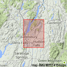
Notable exposures in Lake George region, [Warren Co.], eastern NY.
Source: Publication; GNC index card files (USGS-Reston).
For more information, please contact Nancy Stamm, Geologic Names Committee Secretary.
Asterisk (*) indicates published by U.S. Geological Survey authors.
"No current usage" (†) implies that a name has been abandoned or has fallen into disuse. Former usage and, if known, replacement name given in parentheses ( ).
Slash (/) indicates name conflicts with nomenclatural guidelines (CSN, 1933; ACSN, 1961, 1970; NACSN, 1983, 2005, 2021). May be explained within brackets ([ ]).