

- Usage in publication:
-
- Bear Gulch limestone lentil
- Modifications:
-
- Original reference
- Dominant lithology:
-
- Limestone
- AAPG geologic province:
-
- Central Montana uplift
Summary:
Pg. 58, 59 (fig. 5), 60 (fig. 6), 62. Bear Gulch limestone lentil of Tyler formation; Bear Gulch limestone member of Tyler formation. Overlain by Amsden sandstone. Removal of soluble beds (Heath gypsum) beneath this unit has caused a remarkable series of solution slump blocks in this area worthy of special study. [Age is Mississippian.]
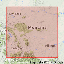
Named from exposures in Bear Gulch [Bear Creek, in T. 14 N., R. 21 E.], Fergus Co., central MT; composite section in secs. 32 and 33, T. 14 N., R. 21 E., south of Forestgrove.
[Called Bear Creek on USGS Forestgrove 7.5-min quadrangle (Maughan, 1984).]
Source: Publication; US geologic names lexicon (USGS Bull. 1200, p. 250).
- Usage in publication:
-
- Bear Gulch tongue
- Modifications:
-
- Revised
- AAPG geologic province:
-
- Central Montana uplift
Summary:
Pg. 1942 (fig. 2), 1953, 1954. Bear Gulch tongue of Cameron Creek member of Tyler formation. Bear Gulch referred to as tongue in Cameron Creek member. Consists of medium-bedded black dense limestone with a marine fauna. Age is Early Pennsylvanian (Morrow).
Source: Publication; US geologic names lexicon (USGS Bull. 1200, p. 250).
- Usage in publication:
-
- Bear Gulch Member*
- Modifications:
-
- Principal reference
- Dominant lithology:
-
- Limestone
- Mudstone
- AAPG geologic province:
-
- Central Montana uplift
- Powder River basin
- Williston basin
Summary:
Pg. 180 (fig. 2), 183 (fig. 4), 185, 187. Bear Gulch Member of Tyler Formation of Amsden Group adopted by the USGS. Chiefly medium-gray to dark-gray, laminated to thin-bedded argillaceous limestone and very calcareous mudstone. Thickness up to 210 feet (subsurface). Intertongues with Stonehouse Canyon Member of Tyler; Maughan and Roberts (1967) included these rocks in Stonehouse Canyon at Potter Creek dome where it is a thin limestone bed about 160 feet (50 m) above base of Tyler. Fossiliferous. Age is Early Pennsylvanian (Morrowan).
Type locality: along Bear Creek, in sec. 21, T. 14 N., R. 21 E., [approx. Lat. 46 deg. 57 min. 15 sec. N., Long. 109 deg. 03 min. 30 sec. W.], Forestgrove 7.5-min quadrangle, Fergus Co., central MT.
Source: Publication.
For more information, please contact Nancy Stamm, Geologic Names Committee Secretary.
Asterisk (*) indicates published by U.S. Geological Survey authors.
"No current usage" (†) implies that a name has been abandoned or has fallen into disuse. Former usage and, if known, replacement name given in parentheses ( ).
Slash (/) indicates name conflicts with nomenclatural guidelines (CSN, 1933; ACSN, 1961, 1970; NACSN, 1983, 2005, 2021). May be explained within brackets ([ ]).