

- Usage in publication:
-
- Bear Den Member
- Modifications:
-
- Named
- Dominant lithology:
-
- Siltstone
- Sandstone
- AAPG geologic province:
-
- Williston basin
Summary:
Bear Den Member of Golden Valley Formation. Name proposed for rocks formerly called the "lower member" of Golden Valley Formation. Recognized in Morton, Oliver, Mercer, Dunn, Stark, Hettinger, Billings, and McKenzie Counties, North Dakota; see isopach map showing known outcrop limits. Is 10.4 m thick at type section; may be more than 9 m thick in Dunn County. Divided into (ascending): (1) gray zone of gray, cross-laminated siltstone, brown-gray, massive, kaolinitic claystone, and gray, very fine-grained, kaolinitic sandstone; (2) orange zone of gray and very pale orange kaolinitic siltstone with limonite spherules; and (3) carbonaceous zone of dark gray, silty, massive, claystone with abundant scattered limonite spherules, and limonite and gypsum as joint fillings. Contacts between zones are transitional. Uppermost part of member (uppermost carbonaceous zone) includes Taylor Bed (informal), a silicified siltstone bed 18 to 60 cm thick. In Mercer County, North Dakota, the Taylor equivalent Alamo Bluff lignite (informal) occurs at top; it averages 1.23 to 7.4 cm thick. Both of these beds serve as valuable, persistent markers. Conformably overlies Sentinel Butte Member of Fort Union Formation; underlies Camels Butte Member (new) of Golden Valley Formation. Distinguished by kaolinitic composition, tripartite color zonation, and barren weathered slopes. Weathers to white, gray, and orange-yellow in contrast to the yellow and tan weathering of overlying Camels Butte. Deposited on a broad, swampy fluvial lowland by aggrading, sluggish streams. Contains standard late Paleocene flora (listed); probably represents the top of the Paleocene. Report includes measured sections, correlation chart, geologic map, isopach map.
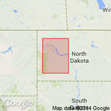
Type section: south of Blue Buttes on tributary of Bear Den Creek, about 12 km northwest of Mandaree, McKenzie Co., ND (Williston basin).
Source: Modified from GNU records (USGS DDS-6; Denver GNULEX).
For more information, please contact Nancy Stamm, Geologic Names Committee Secretary.
Asterisk (*) indicates published by U.S. Geological Survey authors.
"No current usage" (†) implies that a name has been abandoned or has fallen into disuse. Former usage and, if known, replacement name given in parentheses ( ).
Slash (/) indicates name conflicts with nomenclatural guidelines (CSN, 1933; ACSN, 1961, 1970; NACSN, 1983, 2005, 2021). May be explained within brackets ([ ]).