- Usage in publication:
-
- Bear Canyon Member*
- Modifications:
-
- Named
- Dominant lithology:
-
- Sandstone
- Limestone
- AAPG geologic province:
-
- Uinta basin
Summary:
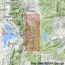
Named as a basal member of Oquirrh Formation in quad. An older member, Bridal Veil Limestone Member does not crop out in quad. Type locality designated in S 1/4 cor. sec 16, T5S, R4E which is on crest of ridge north of Bear Canyon, Wasatch Co., UT in the Uinta basin. Consists of gray to tan and reddish-brown, limy to quartzitic sandstone with thin to thick beds of gray to black limestone, in part sandy, and in part with abundant nodules and stringers of black chert. Is 8,350 ft thick at type; is about 4,000 ft thick in South Fork of Provo River. Overlain by Shingle Mill Limestone Member. Contains fossils of Atokan and Des Moinesian, or Middle Pennsylvanian age in adjoining quadrangles. Approximate correlative of Butterfield Peaks Formation of Oquirrh Group in Oquirrh Mountains.
Source: GNU records (USGS DDS-6; Denver GNULEX).
For more information, please contact Nancy Stamm, Geologic Names Committee Secretary.
Asterisk (*) indicates published by U.S. Geological Survey authors.
"No current usage" (†) implies that a name has been abandoned or has fallen into disuse. Former usage and, if known, replacement name given in parentheses ( ).
Slash (/) indicates name conflicts with nomenclatural guidelines (CSN, 1933; ACSN, 1961, 1970; NACSN, 1983, 2005, 2021). May be explained within brackets ([ ]).

