

- Usage in publication:
-
- Beacon Flat formation
- Modifications:
-
- Original reference
- AAPG geologic province:
-
- Great Basin province
Summary:
Pg. 1694-1695 (geol. map), 1697-1699. Beacon Flat formation. Poorly exposed on Beacon Flat, Elko County, Nevada. Divided into unnamed lower and upper members separated by an estimated 1,100 feet-thick covered interval (middle member). Lower member, exposed on west side of Beacon Flat, consists of silty calcisiltites and calcilutites interbedded with clean, gray and tan calcarenites, sparsely fossiliferous; thickness about 550 feet; possibly correlative with upper part of Nolan and others' 1956 (USGS Prof. Paper 276, p. 67-68) Carbon Ridge formation in Eureka area, Eureka County, Nevada. Upper member, exposed on east side of Beacon Flat, consists of massive and thick-bedded gray calcarenites, dolomitized in places and containing poorly preserved fossils (fusulinids, brachiopods, bryozoans, crinoids); thickness about 1,140 feet. Total thickness of formation about 2,800 feet. Conformably overlies Buckskin Mountain formation; top of transitional zone marked by a limestone-pebble conglomerate. Conformably underlies Carlin Canyon formation. Age is Permian (Wolfcampian and Leonardian), based on fossils (fusulinids, corals) identified from lower member. Report includes measured section, geologic map.
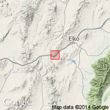
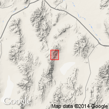
Type section [composite]: on north side of Humboldt River at Carlin Canyon, [Grindstone Mountain and Carlin East 7.5-min quadrangles], Elko Co., NV; lower member in SE/4 SE/4 NW/4 and NE/4 NE/4 SW/4 sec. 15, T. 33 N., R. 53 E., and upper member in SW/4 SE/4 and SE/4 SW/4 sec. 14, and in NW/4 sec. 23, T. 33 N., R. 53 E. Origin of name not stated, but probably named from Beacon Flat.
Source: Publication.
- Usage in publication:
-
- Beacon Flat Formation
- Modifications:
-
- Age modified
- AAPG geologic province:
-
- Great Basin province
Summary:
Age of the Beacon Flat Formation is Early Permian.
Source: GNU records (USGS DDS-6; Menlo GNULEX).
For more information, please contact Nancy Stamm, Geologic Names Committee Secretary.
Asterisk (*) indicates published by U.S. Geological Survey authors.
"No current usage" (†) implies that a name has been abandoned or has fallen into disuse. Former usage and, if known, replacement name given in parentheses ( ).
Slash (/) indicates name conflicts with nomenclatural guidelines (CSN, 1933; ACSN, 1961, 1970; NACSN, 1983, 2005, 2021). May be explained within brackets ([ ]).