- Usage in publication:
-
- Bayou Manard member
- Modifications:
-
- Original reference
- Dominant lithology:
-
- Limestone
- Shale
- AAPG geologic province:
-
- Chautauqua platform
- Arkoma basin
Summary:
Pg. 51-54, pls. 1-5. Bayou Manard member of Moorefield formation of Mayes group. At type locality, composed of black argillaceous limestones and interbedded black calcareous shales; limestones vary from lithographic to medium crystalline; strata are commonly jointed in proximity to major faulting, forming large rectangular blocks; lithology fairly constant eastward to vicinity of Stilwell where it intergrades with medium-crystalline limestone of overlying Lindsey Bridge member (new). Northward along Grand River in Mayes and Wagoner Counties, consists of lower sequence of blue-gray dense fine-grained to lithographic limestone with thin beds and nodules of black chert succeeded by upper thin to platy weathering limestone. Maximum thickness 65 feet. Lies unconformably upon Tahlequah member and, in different areas, upon other older Mississippian rocks, Keokuk chert, Reeds Spring formation, and Chattanooga black shale. Age is Late Mississippian (Chester).
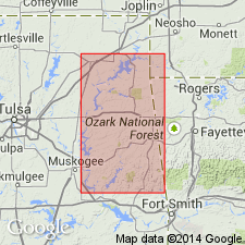
Type locality: southeast of Muskogee and Fort Gibson, in SE/4 sec. 19, T. 15 N., R. 20 E., southwest of bridge over Bayou Manard, [Fort Gibson Dam 7.5-min quadrangle], Muskogee Co., northeastern OK. Named from exposures along Bayou Manard.
Source: US geologic names lexicon (USGS Bull. 1200, p. 244).
For more information, please contact Nancy Stamm, Geologic Names Committee Secretary.
Asterisk (*) indicates published by U.S. Geological Survey authors.
"No current usage" (†) implies that a name has been abandoned or has fallen into disuse. Former usage and, if known, replacement name given in parentheses ( ).
Slash (/) indicates name conflicts with nomenclatural guidelines (CSN, 1933; ACSN, 1961, 1970; NACSN, 1983, 2005, 2021). May be explained within brackets ([ ]).

