

- Usage in publication:
-
- Bautista beds
- Modifications:
-
- Named
- Dominant lithology:
-
- Conglomerate
- Clay
- AAPG geologic province:
-
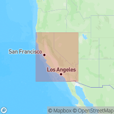
- Peninsular Ranges province
Summary:
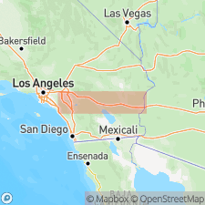
[Probably named for] Bautista Creek or Bautista Creek Badlands which lie within foothills of San Jacinto Mountain, six mi to southeast of badlands of San Timoteo Canyon, San Jacinto quad, southern CA. Type locality of Bautista fossils is south of San Jacinto River. Pleistocene vertebrate fossils were evidently accumulated in part in playa-like lake as series of fine, worked-over fanglomerates and clays derived from low highlands of immediate north and east. List and description of fossils included.
Source: GNU records (USGS DDS-6; Menlo GNULEX).
- Usage in publication:
-
- Bautista beds
- Modifications:
-
- Areal extent
- AAPG geologic province:
-
- Peninsular Ranges province
Summary:
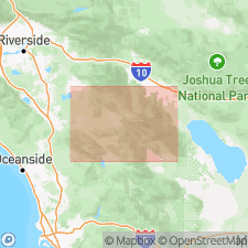
Mapped in San Jacinto quad south of San Gorgonio Pass, CA. Described as coarse, loosely consolidated, lenticular, grayish sandstone and poorly lithified shale, 1500 or 2000 feet thick, with areal extent of about 25 sq mi. In Vandeventer Flat area beds have areal extent of 8 or 10 sq mi and are chiefly composed of arkosic sandstone. Is Pleistocene age.
Source: GNU records (USGS DDS-6; Menlo GNULEX).

- Usage in publication:
-
- Bautista formation
- Modifications:
-
- Revised
- AAPG geologic province:
-
- Peninsular Ranges province
Summary:
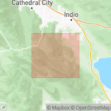
Bautista beds (Fraser, 1931) is formally named Bautista formation. Is exposed in several areas along San Jacinto fault zone (San Jacinto River wash, Hemet Valley-Vandeventer Flat, Park Hill, and adjacent to Horse Creek). Small area at head of Diamond Valley, 6 mi south of Hemet, is mapped as older alluvium by MacRostie and Dolcini (1959) rather than as Bautista. Because Bautista formation is as deformed as nearby Pliocene formation, geologic evidence suggests it is not younger than early Pleistocene. Lists of Bautista fauna and flora included.
Source: GNU records (USGS DDS-6; Menlo GNULEX).
- Usage in publication:
-
- Bautista beds
- Modifications:
-
- Age modified
- AAPG geologic province:
-
- Peninsular Ranges province
Summary:
Shown on generalized geologic map of San Jacinto fault zone as Tertiary(?) and Pleistocene age.
Source: GNU records (USGS DDS-6; Menlo GNULEX).
- Usage in publication:
-
- Bautista Formation
- Modifications:
-
- Age modified
- AAPG geologic province:
-
- Peninsular Ranges province
Summary:
Consists of poorly indurated fanglomerate deposits that were shed southwestward during uplift of Santa Rosa Mountains. Unconformably overlies Peninsular Ranges batholith and Santa Rosa mylonite zone. Age is Pliocene and/or Pleistocene.
Source: GNU records (USGS DDS-6; Menlo GNULEX).
For more information, please contact Nancy Stamm, Geologic Names Committee Secretary.
Asterisk (*) indicates published by U.S. Geological Survey authors.
"No current usage" (†) implies that a name has been abandoned or has fallen into disuse. Former usage and, if known, replacement name given in parentheses ( ).
Slash (/) indicates name conflicts with nomenclatural guidelines (CSN, 1933; ACSN, 1961, 1970; NACSN, 1983, 2005, 2021). May be explained within brackets ([ ]).