

- Usage in publication:
-
- Baum lentil
- Modifications:
-
- Original reference
- Dominant lithology:
-
- Limestone
- AAPG geologic province:
-
- South Oklahoma folded belt
Summary:
Pg. 7 (stop 3). Name Baum lentil proposed for marly limestone in basal Trinity [formation]. Type locality stated.
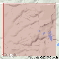
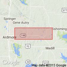
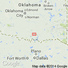
Type locality: hill 1.2 mi east of Baum, in NE/4 SE/4 sec. 36, T. 3 S., R. 3 E., Carter Co., southern OK.
Source: US geologic names lexicon (USGS Bull. 1200, p. 241).
- Usage in publication:
-
- Baum limestone
- Modifications:
-
- Incidental mention
- AAPG geologic province:
-
- South Oklahoma folded belt
Summary:
Pg. 3, 4. Mentioned in road log as Baum limestone at base of Trinity.
Source: US geologic names lexicon (USGS Bull. 1200, p. 241).
- Usage in publication:
-
- Baum limestone member
- Modifications:
-
- Principal reference
- Dominant lithology:
-
- Limestone
- AAPG geologic province:
-
- South Oklahoma folded belt
Summary:
Pg. 2400-2406. Baum limestone member of Paulxy sand. Formally proposed. Consists of four intergrading lithofacies: (1) basal red clay, up to 28 feet thick, which disappears eastward, (2) limestone conglomerate, up to 42 feet thick, which is best developed at northern margin of outcrop near Arbuckle Mountains, ( 3) massive fine-grained limestone, up to 73 feet thick, which is the thickest and most widely distributed of the units, and ( 4) arkosic limestone and calcareous arkose, present only in eastern outcrop area near Ravia. Because of irregular distribution, each of these units locally is at base of the Baum. Thickness ranges from 13 feet on Turkey Creek, where top and base are exposed, to maximum of 73 feet on Washita River where base is not exposed and top is eroded. In vicinity of type locality, the Baum rests on steeply dipping Pennsylvanian rocks; it disappears westward, apparently by interfingering with Paluxy sand; in easternmost outerop rests on Precambrian granite and pre-Pennsylvanian highly folded rocks; in Ardmore basin, rests on steeply dipping Pennsylvanian shales and sandstones, northern extent is marked here by steep escarpment at top of Sycamore limestone (Mississippian). Fossils (charophyte oogonia). Age is Early Cretaceous.
Type locality: hill 1.2 mi east of Baum, in NE/4 SE/4 sec. 36, T. 3 S., R. 3 E., Carter Co., southern OK. Three of the lithofacies are exposed here. Named from Baum, in SW/4 NE/4 sec. 35, T. 3 S., R. 3 E., Carter Co, southern OK.
Source: US geologic names lexicon (USGS Bull. 1200, p. 241).
For more information, please contact Nancy Stamm, Geologic Names Committee Secretary.
Asterisk (*) indicates published by U.S. Geological Survey authors.
"No current usage" (†) implies that a name has been abandoned or has fallen into disuse. Former usage and, if known, replacement name given in parentheses ( ).
Slash (/) indicates name conflicts with nomenclatural guidelines (CSN, 1933; ACSN, 1961, 1970; NACSN, 1983, 2005, 2021). May be explained within brackets ([ ]).