The National Geologic Map Database is migrating to a new infrastructure. We apologize for any service disruptions during this process.
|
|---|


- Usage in publication:
-
- Battle formation*
- Modifications:
-
- Original reference
- Dominant lithology:
-
- Conglomerate
- Sandstone
- Shale
- Limestone
- AAPG geologic province:
-
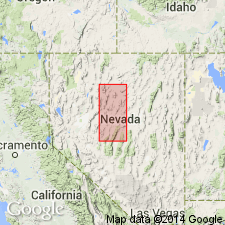
- Great Basin province
Summary:
Battle formation. Reddish-brown to dark-red conglomerate, with interbedded sandstone, shale, and thin limestone beds. Lower beds conglomerates; middle beds interbedded conglomerate, sandstone, and shaly sandstone; upper beds interbedded pebble conglomerate, sandstone, shale, calcareous shale, and limestone. Shale and limy beds metamorphosed to hornfels, and conglomerates and sandstones to quartzite near intrusive bodies; generally bleached white or light gray. Thickness at type locality 700 feet. Rests with angular unconformity on three older formations of lower plate sequence. Is older than Antler Peak limestone. Fossils collected at type section, about 400 feet above base, include CHAETETES sp. and fusulinid OZAWAINELLA; L.G. Henbest [written commun., 1951] considers them Des Moines. Age is [Middle] Pennsylvanian (Des Moines).
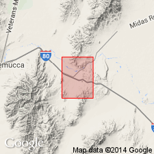
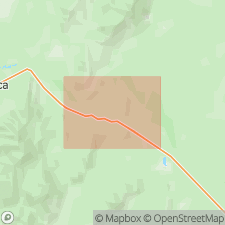
Type section: on west side of Cow Canyon, a tributary of Galena Canyon, southeast flank of Antler Peak, [in W/2 sec. 3 and E/4 sec. 4, T. 31 N., R. 43 E., approx. Lat. 40 deg. 35 min. 12 sec. N., Long. 117 deg. 07 min. 40 sec. W.], Battle Mountain, Antler Peak 15-min quadrangle, Lander Co., central northern NV. [Named from Battle Mountain].
Source: Publication; US geologic names lexicon (USGS Bull. 1200, p. 238-239).
- Usage in publication:
-
- Battle formation*
- Modifications:
-
- Areal extent
- AAPG geologic province:
-
- Great Basin province
Summary:
Battle formation. Upper 300 feet interbedded conglomerate, sandstone, shale, calcareous shale, and limestone. Middle 250 feet interbedded conglomerate, sandstone, and shale. Upper and middle parts largely marine. Lower 150 feet coarse conglomerate, probably terrestrial. Thickness 800 feet at head of Galena Canyon in Battle Mountain, elsewhere 0 to about 100 feet thick. In Edna Mountain present only as lenses of coarse conglomerate about 30 feet thick. Separated from underlying Mississippian(?) Harmony and Scott Canyon formations, and Middle(?) Ordovician Valmy formation by angular unconformity. Coarse conglomerates of the lower part of Battle formation near Antler Peak indicate at least local steep topography and suggest that deposition may have closely followed the folding and subsequent uplift and erosion of underlying formations. Conformably underlies Antler Peak limestone. Fossils from limestone beds near middle of Battle Mountain section indicate [middle] Pennsylvanian (Des Moines) age.
Type locality stated to be on east flank of Antler Peak.
Source: Publication; US geologic names lexicon (USGS Bull. 1200, p. 238-239).
- Usage in publication:
-
- Battle formation*
- Modifications:
-
- Areal extent
- Age modified
- AAPG geologic province:
-
- Great Basin province
Summary:
Pg. 2824 (fig. 5), 2825 (fig. 6), 2841-2842. Battle formation. Recognized in Hot Springs Range and Osgood Mountains, Humboldt County, southeastward into Cortez Mountains, Eureka County, Nevada. Is mostly coarse red to brown conglomerate with minor amounts of interbedded sandstone, shale, and limestone. Thickness at most places about 100 feet; 700 feet at type locality. Unconformably overlies unnamed Mississippian rocks, Devonian Pilot Shale, or Ordovician Valmy Formation. Unconformably underlies Pennsylvanian to Permian Antler Peak limestone. Interfingers with, and is considered age-equivalent of Highway limestone. Age is early Middle Pennsylvanian, based on fusulinid fauna identified from limestone lenses in upper part of formation. Lower beds contain plant fragments and may have been deposited under terrestrial conditions, but upper beds are clearly marine.
Source: Publication; US geologic names lexicon (USGS Bull. 1200, p. 238-239); GNU records (USGS DDS-6; Menlo GNULEX).
- Usage in publication:
-
- Battle Formation*
- Modifications:
-
- [Principal reference]
- Age modified
- AAPG geologic province:
-
- Great Basin province
Summary:
Pg. A4, A11 (fig. 3), A13 (chart), A27-A32, A72 (fig. 33), pls. 2, 4, 7. Battle Formation. Chiefly interbedded conglomerate and sandstone, together with some shale, calcareous shale, and limestone. In Copper Basin area, rocks have undergone contact metamorphism and subsequent hydrothermal alteration; formation is host of principal ore bodies. At type locality, consists of (descending): (1) upper part, 258 feet thick, interbedded red, yellow, and buff sandstones, pebble conglomerate, and reddish to buff shaly layers, locally calcareous, contains few fossils; (2) middle part, 74 feet thick, varicolored pebble and granule conglomerate interbedded with sandstone, shale, calcareous shale, and limestone, contains fossils in middle; and (3) lower part, 398 feet thick, medium- to thick-bedded conglomerate, characteristically medium to deep red where unmetamorphosed, locally contains plant fragments near base. Total thickness at type locality about 730 feet; elsewhere thickness is much less. Disconformably underlies Antler Peak Limestone. Overlies Scott Canyon, Valmy, and Harmony Formations with angular unconformity. Middle and upper parts of Battle Formation considered limestone facies equivalent of Highway Limestone at Edna Mountain. Fusulinids [listed] and CHAETETES from upper part of Battle Formation at the type locality indicate Atokan (L.G. Henbest and R.C. Douglass, written commun., 1953). Age is Middle Pennsylvanian.
Type locality (composite section): Antler Peak, Antler Peak 15-min quadrangle, Lander Co., central northern NV: upper part (section A) measured 500 ft. southeast of Antler Peak [in SE/4 SE/4 sec. 33, T. 32 N., R. 43 E., approx. Lat. 40 deg. 35 min. 54 sec. N., Long. 117 deg. 07 min. 54 sec. W.]; lower part (section B) measured at head of Cow Canyon, due east from quarter corner btw. secs. 3 and 4, T. 31 N., R. 43 E., [approx. Lat. 40 deg. 35 min. 15 sec. N., Long. 117 deg. 07 min. 18 sec. W.]. Named from Battle Mountain.
[Additional locality information from USGS GNIS database, USGS historical topographic map collection TopoView, and ACME Mapper 2.1 https://mapper.acme.com; accessed Memorial Day, 2018.]
Source: Publication.
- Usage in publication:
-
- Battle Conglomerate*
- Modifications:
-
- Redescribed
- Mapped
- Dominant lithology:
-
- Conglomerate
- AAPG geologic province:
-
- Great Basin province
Summary:
Pg. 9 (table 1), 43-44, pl. 1 (geol. map), pl. 3 (corr. chart). Battle Conglomerate. Present in the northern part of Mount Lewis 15-min quadrangle, Lander County, Nevada, in the upper plate of the Whisky Canyon thrust (Antler Peak facies); exposures are small and discontinuous. Consists mostly of coarse conglomerate; includes some sandstones and marls in places. Because here it is so predominantly conglomerate, it is locally designated Battle Conglomerate. Thickness about 50 to 400 feet. Unconformably overlies Valmy Formation; underlies Antler Peak Limestone. Age is considered Middle Pennsylvanian (Desmoinesian), based on fossils from limestone beds intercalated in Battle Formation (Roberts, 1951) at its type locality nearby in Antler Peak quadrangle. [Report includes geologic map, correlation chart.]
Source: Publication.
- Usage in publication:
-
- Battle Formation*
- Modifications:
-
- Age modified
- Biostratigraphic dating
- AAPG geologic province:
-
- Great Basin province
Summary:
Battle Formation. Age changed from Middle Pennsylvanian to Early Pennsylvanian. Conodonts from NE/4 sec. 10, T. 33 N., R. 41 E. [in adjacent Brooks Spring 7.5-min quadrangle] suggest an Early Pennsylvanian age (J.W. Huddle, USGS, written commun., 1973; USGS 25061-PC). Battle Formation described as chiefly quartzite and boulder conglomerate derived from Osgood Mountain Quartzite. Locally includes gray medium-grained quartzite and sandy limestone beds. Occurs as discontinuous patches and lenses as much as 60 ft thick (shear slices?) thrust on Cambrian Preble Formation.
Source: Publication; Changes in stratigraphic nomenclature, 1975 (USGS Bull. 1422-A, p. A2-A3).
- Usage in publication:
-
- Battle Formation*
- Modifications:
-
- Revised
- AAPG geologic province:
-
- Great Basin province
Summary:
Mapped undifferentiated as part of Antler sequence which includes (ascending): Battle Formation, Antler Peak Limestone, and Edna Mountain Formation. On Battle Mountain, Battle Formation ranges in thickness from 50 to 200 ft in northwestern part and to about 730 ft in south-central part. Contains fusulinids of Atokan Series of Pennsylvanian Period. Overlies with marked angular discordance folded and faulted rocks of Scott Canyon, Valmy, and Harmony Formation. Disconformably underlies Antler Peak Limestone.
Source: GNU records (USGS DDS-6; Menlo GNULEX).
- Usage in publication:
-
- Battle Formation
- Modifications:
-
- Not used
- AAPG geologic province:
-
- Great Basin province
Summary:
Pg. 655, 659-662 (figs.). Battle Formation. In Edna Mountain area, Humboldt County, central northern Nevada, rocks previously correlated with Battle Formation (e.g., Erickson, R.L., and Marsh, S.P., 1974, USGS Jour. Research, v. 2, no. 3, p. 331-337; Saller, A.H., and Dickinson, W.R., 1982, Jour. Sed. Petrol., v. 52, no. 3, p. 925-940), are here informally renamed the Iron Point conglomerate. Gradationally underlies Highway Limestone (Morrowan to Atokan). Predates type Battle Formation (Atokan) at Antler Peak, 70 km to southeast (Roberts, 1964; Theodore, T.G., 2000, Tucson, Arizona, Mon. Min. Res. Sci., no. 2, Center Min. Res., and references therein).
The informal Iron Point conglomerate is a dark-brown- to red-brown-weathering, well-sorted, locally stratified, pebble to boulder conglomerate. Lower part truncated. In fault contact (Iron Point fault) with underlying lower Paleozoic Preble Formation. Age is considered early Early Pennsylvanian or older (early Morrowan or pre-Morrowan). Fusulinids recovered during the course of study from the base of overlying unit, i.e., the Highway Limestone, are Morrowan in age.
Source: Publication.
For more information, please contact Nancy Stamm, Geologic Names Committee Secretary.
Asterisk (*) indicates published by U.S. Geological Survey authors.
"No current usage" (†) implies that a name has been abandoned or has fallen into disuse. Former usage and, if known, replacement name given in parentheses ( ).
Slash (/) indicates name conflicts with nomenclatural guidelines (CSN, 1933; ACSN, 1961, 1970; NACSN, 1983, 2005, 2021). May be explained within brackets ([ ]).