- Usage in publication:
-
- Battiest Chert Member
- Modifications:
-
- Original reference
- Dominant lithology:
-
- Chert
- AAPG geologic province:
-
- Ouachita folded belt
Summary:
Battiest Chert Member of Tenmile Creek Formation of Stanley group. Proposed for chert member in middle part of formation. Battiest chert member was named †Smithville chert lentil [not incl. in this lexicon; see USGS Bull. 896, p. 2014] by Miser and Honess, 1927 (Oklahoma Geol. Survey Bull., no. 44, p. 11); this name was little used and was abandoned by Oklahoma Geol. Survey in 1957. Where best exposed, west of Battiest, member is 15 feet thick and consists of 3-inch beds of dark cherty siliceous shale interbedded with black siliceous shale; one 6-inch bed of black chert is cut by veins of milky quartz. Near Beachton (in type area of Honess' and Miser's Smithville chert) member consists of 15 feet of blue-black chert and siliceous shale which is poorly exposed in series of tight folds trending east-west. Age is Late Mississippian (Meramec).
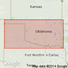
Well exposed along half-section- and section-line roads near village of Battiest in secs. 7 and 8, T. 2 S., R. 23 E., McCurtain Co., southeastern OK. Area is Boktukola syncline.
See also O.B. Shelburne, Jr., 1960, Oklahoma Geol. Survey Bull., no. 88, p. 16, 17 (fig. 2), 18-19, pl. 1.
Source: US geologic names lexicon (USGS Bull. 1200, p. 238).
For more information, please contact Nancy Stamm, Geologic Names Committee Secretary.
Asterisk (*) indicates published by U.S. Geological Survey authors.
"No current usage" (†) implies that a name has been abandoned or has fallen into disuse. Former usage and, if known, replacement name given in parentheses ( ).
Slash (/) indicates name conflicts with nomenclatural guidelines (CSN, 1933; ACSN, 1961, 1970; NACSN, 1983, 2005, 2021). May be explained within brackets ([ ]).

