The National Geologic Map Database is migrating to a new infrastructure. We apologize for any service disruptions during this process.
|
|---|


- Usage in publication:
-
- Battie quartzite*
- Modifications:
-
- Original reference
- Dominant lithology:
-
- Quartzite
- Conglomerate
- AAPG geologic province:
-
- New England province
Summary:
Pg. 3. Battie quartzite. Massive buff quartzite and clean, buff-colored quartzite conglomerate of very striking appearance. The quartzite conglomerate makes up Mount Battie. Thickness 400 to 500 feet. Overlies Islesboro formation and conformably underlies Penobscot formation. Assigned to Cambrian(?).
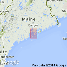
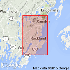
Named from development on Mount Battie, a small mountain on mainland north of Camden, Knox Co., Rockland quadrangle, central southern ME.
[GNC remark (ca. 1936, US geologic names lexicon, USGS Bull. 896, p. 126): On 1933 geol. map of Maine, by A. Keith, these rocks are included in the Ordovician and Cambrian block.]
Source: US geologic names lexicon (USGS Bull. 896, p. 126).
- Usage in publication:
-
- Battie quartzite
- Modifications:
-
- Areal extent
- AAPG geologic province:
-
- New England province
Summary:
Pg. 79. Sequence of metamorphosed sedimentary rocks in area of Rockland quadrangle, Knox County, is (ascending) Islesboro formation containing Coombs limestone member at top; Battie quartzite; Penobscot formation; and Rockland formation consisting of Weskeag quartzite member at base, a siliceous limestone member above the quartzite, and Rockport limestone member at top.
Source: US geologic names lexicon (USGS Bull. 1200, p. 238).
- Usage in publication:
-
- Battie Formation
- Modifications:
-
- Geochronologic dating
- AAPG geologic province:
-
- New England province
Summary:
Pg. 135 (table 1), 140 (table 5). Battie Formation. Age is considered Silurian(?) based on Rb-Sr (whole rock) age of 425 +/-35 Ma.
Source: GNC index card files (USGS-Reston).
For more information, please contact Nancy Stamm, Geologic Names Committee Secretary.
Asterisk (*) indicates published by U.S. Geological Survey authors.
"No current usage" (†) implies that a name has been abandoned or has fallen into disuse. Former usage and, if known, replacement name given in parentheses ( ).
Slash (/) indicates name conflicts with nomenclatural guidelines (CSN, 1933; ACSN, 1961, 1970; NACSN, 1983, 2005, 2021). May be explained within brackets ([ ]).