The National Geologic Map Database is migrating to a new infrastructure. We apologize for any service disruptions during this process.
|
|---|


- Usage in publication:
-
- Bath sandstone sub-member [informal]
- Modifications:
-
- Original reference
- Dominant lithology:
-
- Sandstone
- Siltstone
- AAPG geologic province:
-
- Eagle basin
- South Park basin
Summary:
Pg. 973, 980, 985, 1,000. Bath sandstone sub-member [informal] of Pony Spring Siltstone Member of Maroon Formation. Arkosic, greenish-gray, micaceous sandstone, with chloritic cement. Strata range from a few tenths of a foot to 8 feet thick, and may alternate with thin layers of greenish-gray to reddish-gray siltstone. Ripple marks common; many layers cross-laminated. Plant fossils abundant at some horizons near base. Rests conformably on Chubb siltstone member. Assigned to Permian.
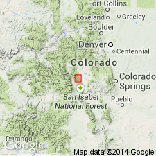
Forms prominent ridge that separates the Platte and Arkansas drainage for several mi northwest of summit of Trout Creek Pass, where is abandoned town of Bath, [Chaffee Co.], central CO. Recognized in Park and Chaffee Cos., central CO.
["Submember" not recognized as a formal stratigraphic rank term (CSN, 1933; ACSN, 1961, 1970; NACSN, 1983, 2005). Considered informal until formally published. The rank or lithologic term should not be capitalized.]
Source: US geologic names lexicon (USGS Bull. 896, p. 126).
- Usage in publication:
-
- Bath sandstone
- Modifications:
-
- Revised
- AAPG geologic province:
-
- Eagle basin
- South Park basin
Summary:
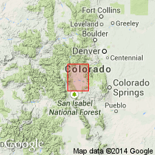
Used as an unranked unit, or lowest sandstone of the Pony Spring siltstone member, middle member of Maroon formation. [Term "sub-members" not used.] Is a unit that forms a prominent ridge which separates the Platte and Arkansas drainages for several mi northwest of the summit of Trout Pass. Mapped with Pony Spring [misspelled Springs on map], Park and Chaffee Cos, CO in the South Park and Eagle basins as a unit of Permian age.
Source: GNU records (USGS DDS-6; Denver GNULEX).
For more information, please contact Nancy Stamm, Geologic Names Committee Secretary.
Asterisk (*) indicates published by U.S. Geological Survey authors.
"No current usage" (†) implies that a name has been abandoned or has fallen into disuse. Former usage and, if known, replacement name given in parentheses ( ).
Slash (/) indicates name conflicts with nomenclatural guidelines (CSN, 1933; ACSN, 1961, 1970; NACSN, 1983, 2005, 2021). May be explained within brackets ([ ]).