

- Usage in publication:
-
- Bassett Member
- Modifications:
-
- Revised
- AAPG geologic province:
-
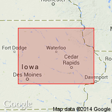
- Iowa shelf
Summary:
Reassigned as a member of Little Cedar Formation (new), basal formation of Cedar Valley Group (rank raised). Lower part of Bassett is stratigraphically equivalent to the Solon Member of Little Cedar. Lies conformably beneath Chickasaw Shale Member or Eagle Center Member of Little Cedar Formation. Disconformably overlies Davenport Member of Pinicon Ridge Formation (new) of Wapsipinicon Group (rank raised). Is dominated by slightly argillaceous to argillaceous dolomite, commonly vuggy, containing scattered to abundant fossil molds. Dolomitic limestones present in lower part. Limestone and dolomitic limestone increase in abundance southward. Chert nodules in upper half. Stylolites and hardgrounds present especially in lower half. Divisible into a lower unit of fossiliferous, argillaceous dolomite and dolomitic limestone; a middle unit of sparsely fossiliferous, slightly argillaceous to argillaceous dolomite, and dolomitic limestone; and an upper unit of fossiliferous, partly argillaceous dolomite. Ranges between 15 and 25 m thick. Assigned to the Middle and Upper VARCUS subzones (conodonts). Also crinoid, bryozoan, trilobite, coral, tentaculitid fossils found. Of Givetian, late Middle Devonian age. Deposited during a transgressive-regressive subcycle. Correlation charts. Graphic sections. Outcrop belt extends from northern IA to southeast MN on the Iowa shelf.
Source: GNU records (USGS DDS-6; Denver GNULEX).
For more information, please contact Nancy Stamm, Geologic Names Committee Secretary.
Asterisk (*) indicates published by U.S. Geological Survey authors.
"No current usage" (†) implies that a name has been abandoned or has fallen into disuse. Former usage and, if known, replacement name given in parentheses ( ).
Slash (/) indicates name conflicts with nomenclatural guidelines (CSN, 1933; ACSN, 1961, 1970; NACSN, 1983, 2005, 2021). May be explained within brackets ([ ]).