The National Geologic Map Database is migrating to a new infrastructure. We apologize for any service disruptions during this process.
|
|---|


- Usage in publication:
-
- Baskahegan Lake Formation
- Modifications:
-
- Named
- Dominant lithology:
-
- Sandstone
- Graywacke
- Slate
- AAPG geologic province:
-
- New England province
Summary:
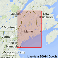
Rocks of the Baskahegan Lake Formation (new name) are thought to be the oldest in the region. They occur in two belts in the Danforth, Scraggly Lake, Forest, and Waite quads. Unit contains massive to well-graded, generally thick-bedded gray, green, and maroon quartzose and quartzofeldspathic sandstones and wackes, interbedded with green and maroon slate. Divided into two informal (unnamed) members based on color, bed thickness, and proportion of sandstone and pelite. Lower member consists of pink to deep red-maroon sandstones and coarse siltstones and interbedded red-maroon slates. Crops out only in the southern belt. Upper member makes up bulk of formation and is composed of green granule conglomerates, sandstones, siltstones, and pelites. Both members are characterized by what author calls "breadslicer" cleavage. Age is inferred from position below Caradocian fossils of the Tolman Hill member of the Stetson Mountain Formation and correlation with the lower Tetagouche Group of CAN and the Grand Pitch Formation in quads. to the northwest. Unit is tentatively assigned a Cambrian(?) and Early Ordovician age. No thickness given.
Source: GNU records (USGS DDS-6; Reston GNULEX).
- Usage in publication:
-
- Baskahegan Lake Formation
- Modifications:
-
- Overview
- AAPG geologic province:
-
- New England province
Summary:
"Rocks of the Miramichi belt are separated by an unconformity into two packages--the Baskahegan Lake Formation and the Kossuth Group, both of which are pre-Ashgillian." The Baskahegan is more complexly deformed than the formations of the overlying Kossuth Group. It is generally thick-bedded and has well-developed Bouma sequence features. Inferred age of the Baskahegan Lake is Late Cambrian through earliest Ordovician. [Unit name is italicized throughout the report. According to authors, it is considered informal at this time, but is being proposed for formal status. No reference is made to Ludman (1991), interpreted as the naming paper by the GNU.]
Source: GNU records (USGS DDS-6; Reston GNULEX).
For more information, please contact Nancy Stamm, Geologic Names Committee Secretary.
Asterisk (*) indicates published by U.S. Geological Survey authors.
"No current usage" (†) implies that a name has been abandoned or has fallen into disuse. Former usage and, if known, replacement name given in parentheses ( ).
Slash (/) indicates name conflicts with nomenclatural guidelines (CSN, 1933; ACSN, 1961, 1970; NACSN, 1983, 2005, 2021). May be explained within brackets ([ ]).