The National Geologic Map Database is migrating to a new infrastructure. We apologize for any service disruptions during this process.
|
|---|


- Usage in publication:
-
- Basey formation
- Modifications:
-
- Areal extent
- AAPG geologic province:
-
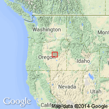
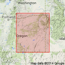
- Snake River basin
Summary:
Weberg, Warm Springs, and Basey (new) formations are lateral equivalents of Snowshoe formation.
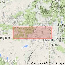
Type locality and derivation of name not stated by author. Report discusses Izee area, Grant Co., central OR.
[Misprint (US geologic names lexicon, USGS Bull. 1200, p. 228): Should be W.R. Dickinson, 1960, Dissert. Abs., v. 20, no. 11 cited, not W.R. Richardson.]
Source: Modified from US geologic names lexicon (USGS Bull. 1200, p. 228).
- Usage in publication:
-
- Basey Member
- Modifications:
-
- Overview
- AAPG geologic province:
-
- Snake River basin
Summary:
Pg. 4, 30, 39-40. Basey Member of Snowshoe Formation. Basey Member first described by Dickinson and Vigrass (1965), who designated type locality in secs. 1, 12, and 13, T. 18 S., R. 25 E., in vicinity of Basey Ranch at head of Camp Creek in the Suplee-Izee district [Grant County], central Oregon. Dickinson and Vigrass (1965) state rocks assigned to the Basey Member were originally assigned to Hyde Formation by Lupher (1941) on basis of lithologic similarity to type Hyde located to the east. (See also entries under Hyde and Mowich.)
Basey Member is widespread in Pine Creek downwarp, situated northwest of western part of Mowich anticline, and also in adjoining structural lows west and southwest of Mowich anticline. Consists of up to 2,500 feet of hard, massive marine volcaniclastic rocks interbedded with andesitic lava. The volcaniclastics consist primarily of dark-gray to blue-gray sandstone composed of 30 to 50 percent plagioclase and 40 to 70 percent zeolitized rock fragments with minor amounts of augite, calcite and quartz. Texturally the volcaniclastics range from slightly reworked marine tuffs to stratified sandstones, mudstones, and siltstones. In western part of Suplee area, includes two porphyritic to aphanitic flows of andesite (total thickness 300 feet); locally, these grade laterally into flow breccias. Flinty, aphanitic tuffs also occur sporadically in Basey Member. The lithology of the coarse volcaniclastics is remarkably similar to that of type Hyde, but the presence of small amounts of bright red or orange shards is diagnostic. Also, the lithic fragments of the Basey tend to be brownish in thin section, whereas those of the Hyde are more green in color. The Basey is conformable with underlying Shaw Member of the Snowshoe Formation. It passes laterally to the east into the middle member of type Snowshoe from which it is separated by an arbitrary cutoff. Age is middle Jurassic (middle Bajocian), on basis of scattered ammonites.
See also Dickinson, W.R., and Vigrass, L.W., 1965, "Geology of the Suplee-Izee area, Cook, Grant, and Harney Counties, Oregon," Oregon Dept. Geol. and Min. Ind. Bull., no. 58, 109 p., geol. map (scale 1:42,000).
Source: Publication.
- Usage in publication:
-
- Basey Member*
- Modifications:
-
- Biostratigraphic dating
- Adopted
- AAPG geologic province:
-
- Snake River basin
Summary:
Basey Member of Snowshoe Formation. Basey Member of Dickinson and Vigrass (1965) is adopted by the USGS as uppermost of 3 members of Snowshoe Formation in Suplee area, eastern Oregon. Overlies Warm Springs Member of Snowshoe. Age is Middle Jurassic. Report includes detailed faunal lists, descriptions, map locations of Bajocian ammonites.
Source: Changes in stratigraphic nomenclature, 1973 (USGS Bull. 1395-A, p. A4-A5); supplemental information from GNU records (USGS DDS-6; Menlo GNULEX, Warm Springs entry).
For more information, please contact Nancy Stamm, Geologic Names Committee Secretary.
Asterisk (*) indicates published by U.S. Geological Survey authors.
"No current usage" (†) implies that a name has been abandoned or has fallen into disuse. Former usage and, if known, replacement name given in parentheses ( ).
Slash (/) indicates name conflicts with nomenclatural guidelines (CSN, 1933; ACSN, 1961, 1970; NACSN, 1983, 2005, 2021). May be explained within brackets ([ ]).