The National Geologic Map Database is migrating to a new infrastructure. We apologize for any service disruptions during this process.
|
|---|


- Usage in publication:
-
- Barton sandstone
- Modifications:
-
- Original reference
- Dominant lithology:
-
- Sandstone
- AAPG geologic province:
-
- Appalachian basin (Eastern Overthrust area)
Summary:
Pg. 573. Barton sandstone. Underlies Barton rider coal; all included in Conemaugh formation. [Age is Pennsylvanian.]
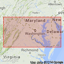
[Notable exposures in Allegany and Garrett Cos., western MD.]
Source: US geologic names lexicon (USGS Bull. 896, p. 121).
- Usage in publication:
-
- Barton sandstone
- Modifications:
-
- Revised
- AAPG geologic province:
-
- Appalachian basin (Eastern Overthrust area)
Summary:
On pl. 6, he applied Barton sandstone to sandstones both overlying and underlying Barton rider coal, but on p. 65 he stated: "A thick sandstone is found locally over the Barton coal at Barton and elsewhere which is named the Barton sandstone from its position." On p. 114 he showed 30 feet of Barton sandstone and shale and underlying Wellersburg limestone and fire clay and overlying Barton rider coal in Castleman basin, western Maryland. [Age is Pennsylvanian.]
See also Wilmarth, M.G., compiler, 1929, Tentative correlation of the named geologic units of Maryland, USGS unpub. corr. chart, Apr., 1929, sheet 1 of 2.
Source: US geologic names lexicon (USGS Bull. 896, p. 121).
For more information, please contact Nancy Stamm, Geologic Names Committee Secretary.
Asterisk (*) indicates published by U.S. Geological Survey authors.
"No current usage" (†) implies that a name has been abandoned or has fallen into disuse. Former usage and, if known, replacement name given in parentheses ( ).
Slash (/) indicates name conflicts with nomenclatural guidelines (CSN, 1933; ACSN, 1961, 1970; NACSN, 1983, 2005, 2021). May be explained within brackets ([ ]).