The National Geologic Map Database is migrating to a new infrastructure. We apologize for any service disruptions during this process.
|
|---|


- Usage in publication:
-
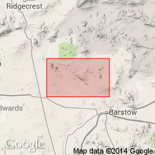
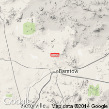
- Barstow formation
- Modifications:
-
- First used
- Dominant lithology:
-
- Silt
- Gravel
- Sand
- AAPG geologic province:
-
- Mojave basin
Summary:
First used for exposures 1.5 miles east of Barstow at a bluff just north of the railroad, Barstow 15' quad, San Bernardino Co. Is extensively developed on the north side of the valley between Barstow and Daggett. Composed of yellow and light-gray silt, dull red fine gravel and sand, red lava fragments, and bed of white tuff with embedded angular and subangular fragments of various rock species. Total thickness 59 ft. Unconformably overlies earlier series [Rosamond and Escondido series]; locally overlain unconformably by Quaternary ridges.
Source: GNU records (USGS DDS-6; Menlo GNULEX).
- Usage in publication:
-
- Barstow formation
- Modifications:
-
- Named
- AAPG geologic province:
-
- Mojave basin
Summary:
Named for exposures in the Mud Hills near Barstow, Opal Mountain and Lane Mountain 15' quads, San Bernardino Co, CA. Assigned to late Miocene.
Source: GNU records (USGS DDS-6; Menlo GNULEX).
- Usage in publication:
-
- Barstow formation*
- Modifications:
-
- Age modified
- Revised
- Biostratigraphic dating
- AAPG geologic province:
-
- Mojave basin
Summary:
Maximum thickness is about 1500 ft. Conformably overlies Spanish Canyon Formation (new) and rests unconformably on older formations. Upper contact conformable and gradational with overlying granitic fanglomerate in downfaulted block of fanglomerate at northwestern corner sec.30 T12N R4E. Previously considered unconformably overlain by Quaternary (Hershey, 1902). Assigned to middle or late Miocene on the basis of vertebrate fossils.
Source: GNU records (USGS DDS-6; Menlo GNULEX).
- Usage in publication:
-
- Barstow Formation*
- Modifications:
-
- Overview
- AAPG geologic province:
-
- Mojave basin
Summary:
Type section designated as south-dipping sequence in eastern Mud Hills just west of Solomon Canyon, sec.20 and N/2 sec.29 T11N R1W, Opal Mountain and Lane Mountain quads, San Bernardino Co, CA. Is 2000 to 3000 ft thick. Unconformably overlies Pickhandle Formation; unconformably overlain by Quaternary alluvium. Upper part late Miocene (Barstovian); middle part middle Miocene (Hemingfordian).
Source: GNU records (USGS DDS-6; Menlo GNULEX).
- Usage in publication:
-
- Barstow Formation
- Modifications:
-
- Revised
- AAPG geologic province:
-
- Mojave basin
Summary:
Barstow Formation in Mud Hills includes in lowermost part Owl Conglomerate Member (new) named after Owl Canyon. Measured sections of Barstow Formation just west of Solomon Canyon and in Mud Hills are 2154 ft and 3035 ft thick, respectively. Shown on geologic map of Fremont Peak and Opal Mountain 15' quads. Map legend gives Miocene(?) age.
Source: GNU records (USGS DDS-6; Menlo GNULEX).
- Usage in publication:
-
- Barstow Formation
- Modifications:
-
- Geochronologic dating
- AAPG geologic province:
-
- Mojave basin
Summary:
Barstow Formation is divided into: (ascending): Owl Conglomerate Member containing Red Tuff [marker bed] near its base and Rak Tuff [marker bed] just below contact between Owl Conglomerate Member and middle unnamed member of formation; middle member containing Oreodont Tuff [marker bed] near its middle part and Yellow Tuff [marker bed] in its upper part; upper unnamed member containing Skyline Tuff, Camel Track Tuff, Dated Tuff, Hemicyon Tuff, Lapilli Sandstone (tuff) [marker beds]. These marker tuff beds have isotopic ages that range from 19.3 +/-0.02 to 13.4 +/-0.2 Ma which are compared to the North American land mammal ages (NALMA). [Note that these marker beds are informal units].
Source: GNU records (USGS DDS-6; Menlo GNULEX).
For more information, please contact Nancy Stamm, Geologic Names Committee Secretary.
Asterisk (*) indicates published by U.S. Geological Survey authors.
"No current usage" (†) implies that a name has been abandoned or has fallen into disuse. Former usage and, if known, replacement name given in parentheses ( ).
Slash (/) indicates name conflicts with nomenclatural guidelines (CSN, 1933; ACSN, 1961, 1970; NACSN, 1983, 2005, 2021). May be explained within brackets ([ ]).