

- Usage in publication:
-
- Barrett shales
- Modifications:
-
- Original reference
- Dominant lithology:
-
- Shale
- Sandstone
- AAPG geologic province:
-
- Powder River basin
Summary:
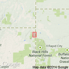
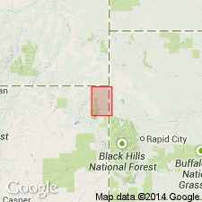
Pg. 593, fig. 122, and map. Barrett shales (Lower Cretaceous). Shales and massive sandstones, unconformably underlying Oak Creek beds and overlying (without positive evidence of unconformity) Hay Creek coal formation in Black Hills, northeastern Wyoming and western South Dakota. Formerly included in Dakota sandstone (Upper Cretaceous). Thickness 45 to 75 feet. [Mapped at and around Barrett, Crook Co., Black Hills area, northeastern WY.]
Source: US geologic names lexicon (USGS Bull. 896, p. 118).
- Usage in publication:
-
- Barrett shale
- Modifications:
-
- Not used
Summary:
Name not used in the area of the Hay Creek coal field, Crook Co, WY. Lakota formation used to include rocks at about the same stratigraphic position.
Source: GNU records (USGS DDS-6; Denver GNULEX).
For more information, please contact Nancy Stamm, Geologic Names Committee Secretary.
Asterisk (*) indicates published by U.S. Geological Survey authors.
"No current usage" (†) implies that a name has been abandoned or has fallen into disuse. Former usage and, if known, replacement name given in parentheses ( ).
Slash (/) indicates name conflicts with nomenclatural guidelines (CSN, 1933; ACSN, 1961, 1970; NACSN, 1983, 2005, 2021). May be explained within brackets ([ ]).