The National Geologic Map Database is migrating to a new infrastructure. We apologize for any service disruptions during this process.
|
|---|


- Usage in publication:
-
- Barrel Springs
- Modifications:
-
- Original reference
- Dominant lithology:
-
- Rhyolite
- Vitrophyre
- Tuff
- AAPG geologic province:
-
- Permian basin
Summary:
Pg. 6-7, geol. map. Barrel Springs Formation. Four rock types are distinguished: black, foliated vitrophyre; pinkish-gray to purplish-brown, foliated, porphyritic rhyolite; non-foliated, porphyritic rhyolite; indurated to friable, fine-grained vitric tuff. Thickness up to about 265 feet; is 105 feet thick at type locality. Overlies Sheep Pasture Formation throughout most of area; at type section overlies Merrill Formation. Underlies Wild Cherry Formation except in northeastern area where it underlies Mount Locke Formation.
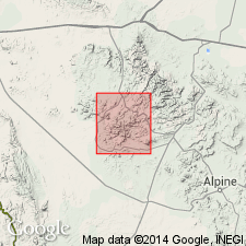
Type section: measured upward from top of Merrill Formation on lower slopes of the northwest side of High Peak [High Point], 2 mi northeast of intersection of Merrill Canyon with State Highway 166, [approx. Lat. 30 deg. 33 min. 50 sec. N., Long. 104 deg. 14 min. 30 sec. W., Paradise Mountain 7.5-min quadrangle], Jeff Davis Co., southwestern TX.
Named from the old Barrel Springs stagecoach stop, now on State Highway 166, approx. Lat. 30 deg. 32 min. N., Long. 104 deg. 13.9 min. W., [Paradise Mountain 7.5-min quadrangle], Jeff Davis Co., southwestern TX.
Source: Publication; US geologic names lexicon (USGS Bull. 1520, p. 18).
- Usage in publication:
-
- Barrel Springs Formation
- Modifications:
-
- Areal extent
- Geochronologic dating
- AAPG geologic province:
-
- Permian basin
Summary:
Barrel Springs Formation mapped in the Davis Mountains area, Jeff Davis and Presidio Cos, west TX in the Permian basin. Mapped alone and as Wild Cherry-Barrel Springs (undivided). Barrel Springs consists of (from top down): indurated to friable, fine-grained vitric tuff; nonfoliated porphyritic rhyolite; pinkish-gray to purplish-brown, foliated porphyritic rhyolite; black, foliated vitrophyre. Thickness is about 105 ft at type locality, and thickens eastward to 250 ft. Thins westward. K-Ar age of 35.6 +/-0.3 m.y. obtained (4 samples). [Unclear on Correlation of Map Units if Barrel Springs is part of Vieja Group.] Shown as above Merrill Formation. [Author states that correlation of volcanic rocks from area to area on Marfa sheet is uncertain--little attempt is made to correlate between areas. The rocks are described by area.] Of Oligocene age. Geologic map.
Source: GNU records (USGS DDS-6; Denver GNULEX).
- Usage in publication:
-
- Barrel Springs Formation
- Modifications:
-
- Geochronologic dating
- AAPG geologic province:
-
- Permian basin
Summary:
Pg. 12. Barrel Springs Formation. Ash-flow tuff (rhyolite) samples from Fort Davis, Big Aguja Mountain, and Mitre Peak quadrangles, Jeff Davis County, southwestern Texas, yielded K-Ar ages from 36.7 +/-1.8 Ma to 35.5 +/-0.8 Ma (alkali feldspar). Data from D.E. Gorski, 1970 (Univ. Texas-Austin MS thesis, 201 p.), D.F. Parker and F.W. McDowell, 1979 (GSA Bull., v. 90, p. 1100-1110), and D.F. Parker (personal commun., 1984); ages recalculated using decay constants of Steiger and Jager, 1977 (Earth Planet. Sci. Letters, v. 36, p. 359-362). [Age considered Eocene to Oligocene. Eocene-Oligocene boundary 36.6 (38-34) Ma (from Geologic Names Committee, USGS, 1983 ed. geol. time scale, with additions from N.J. Snelling, 1985, The Geol. Soc. Mem., no. 10).]
Source: Publication.
For more information, please contact Nancy Stamm, Geologic Names Committee Secretary.
Asterisk (*) indicates published by U.S. Geological Survey authors.
"No current usage" (†) implies that a name has been abandoned or has fallen into disuse. Former usage and, if known, replacement name given in parentheses ( ).
Slash (/) indicates name conflicts with nomenclatural guidelines (CSN, 1933; ACSN, 1961, 1970; NACSN, 1983, 2005, 2021). May be explained within brackets ([ ]).