The National Geologic Map Database is migrating to a new infrastructure. We apologize for any service disruptions during this process.
|
|---|


- Usage in publication:
-
- Barrancas Limestone Member*
- Modifications:
-
- Named
- Dominant lithology:
-
- Limestone
- AAPG geologic province:
-
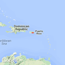
- Caribbean region
Summary:
The Barrancas Limestone Member, here named the basal unit of the Magueyes Formation, was described by Briggs and Gelabert (1962) as the limestone unit of formation L. Consists of 60 m of thick-bedded, dark-gray to black, highly fossiliferous, finely crystalline limestone with basal mudstone. Lies with structural conformity on volcanic rocks of formation L, underlies tuffaceous sandstone and siltstone of the Magueyes. Correlates with Torrecilla Breccia and with the Rio Maton Limestone Member of the Robles Formation. Age is Albian.
Source: GNU records (USGS DDS-6; Reston GNULEX).

- Usage in publication:
-
- Barrancas Limestone Member*
- Modifications:
-
- Overview
- AAPG geologic province:
-
- Caribbean region
Summary:
The Barrancas Limestone Member of the Magueyes Formation occurs in central Puerto Rico. Member occurs at base of formation and is of Early Cretaceous age.
Source: GNU records (USGS DDS-6; Reston GNULEX).
For more information, please contact Nancy Stamm, Geologic Names Committee Secretary.
Asterisk (*) indicates published by U.S. Geological Survey authors.
"No current usage" (†) implies that a name has been abandoned or has fallen into disuse. Former usage and, if known, replacement name given in parentheses ( ).
Slash (/) indicates name conflicts with nomenclatural guidelines (CSN, 1933; ACSN, 1961, 1970; NACSN, 1983, 2005, 2021). May be explained within brackets ([ ]).