- Usage in publication:
-
- Barneston formation
- Modifications:
-
- Original reference
- Dominant lithology:
-
- Limestone
- Chert
- AAPG geologic province:
-
- Nemaha anticline
- Chautauqua platform
Summary:
Pg. 41. Barneston formation of Chase group. Erected to include Florence flint and Fort Riley limestone, which are in contact, except at a few places where a thin shale intervenes. The Florence or lower member is distinguished from the Fort Riley by its abundant chert content. The members are usually mapped together as Fort Riley-Florence. Their average combined thickness from southern Kansas to Nebraska is 50 feet or more. They constitute a strong formation which produces bold round escarpments. Occurs below Doyle formation and above Matfield formation, both of Chase group. Age is Permian (Big Blue).
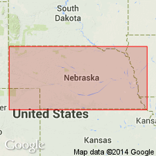
Type locality: in bluffs west and southwest of Barneston, Gage Co., southeastern NE.
Source: US geologic names lexicon (USGS Bull. 896); GNC KS-NE Permian Corr. Chart, Oct. 1936.

- Usage in publication:
-
- Barneston limestone
- Modifications:
-
- Revised
Summary:
Pg. 12 (fig. 4), 69 (fig. 45). Barneston limestone of Chase group. Includes Oketo shale member (new). Age is Permian.
Source: US geologic names lexicon (USGS Bull. 1200, p. 216); GNC KS-NE Permian Corr. Chart, Oct. 1936.

- Usage in publication:
-
- Barneston limestone
- Modifications:
-
- Overview
Summary:
Pg. 44-45. Barneston limestone. Includes (ascending) Florence limestone, Oketo shale, and Fort Riley limestone members. Thickness 80 to 90 feet. Underlies Holmesville shale member of Doyle shale; overlies Blue Springs shale member of Matfield shale. Age is Early Permian (Wolfcamp).
Source: US geologic names lexicon (USGS Bull. 1200, p. 216).

- Usage in publication:
-
- Barneston limestone
- Modifications:
-
- Overview
Summary:
(Paleozoic Era; Permian System by H.G. O'Connor, D.E. Zeller, C.K. Bayne, J.M Jewett, and Ada Swineford, p. 48.) Barneston Limestone of Chase Group. In Kansas, comprises two thick limestone members separated by a thin shale member [Florence Limestone Member, Oketo Shale Member, Fort Riley Limestone Member]. Caps much of the western part of the Flint Hills. The upper limestone [Fort Riley] makes an extensive dip slope and crops out as a steep escarpment that extends north to south across eastern Kansas. Thickness about 80 to 90 feet. Occurs above Blue Springs Shale Member of Matfield Shale and below Holmesville Shale Member of Doyle Shale, both of Chase Group. Age is Early Permian; Gearyan Provincial Stage (of H.G. O'Connor, 1963, AAPG Bull., v. 47, p. 1873-1877).
Source: Publication.
For more information, please contact Nancy Stamm, Geologic Names Committee Secretary.
Asterisk (*) indicates published by U.S. Geological Survey authors.
"No current usage" (†) implies that a name has been abandoned or has fallen into disuse. Former usage and, if known, replacement name given in parentheses ( ).
Slash (/) indicates name conflicts with nomenclatural guidelines (CSN, 1933; ACSN, 1961, 1970; NACSN, 1983, 2005, 2021). May be explained within brackets ([ ]).

