

- Usage in publication:
-
- Barlow Gneiss Member
- Modifications:
-
- Original reference
- Dominant lithology:
-
- Gneiss
- AAPG geologic province:
-
- Piedmont-Blue Ridge province
Summary:
The Barlow Gneiss Member of the Pumpkinvine Creek Formation, here named, is in the Dahlonega, Georgia, area. Consists of gray, pin-striped-appearing muscovite-biotite-plagioclase-quartz gneiss locally interlayered with amphibolites. Lithologically similar to and may be correlative with the Galts Ferry Gneiss Member (new name) of McConnell and Abrams (1984) of the Pumpkinvine Creek. Is a well-exposed marker horizon and is sharply bounded by undifferentiated amphibolite of the Pumpkinvine Creek. Age is Late Proterozoic and (or) early Paleozoic.
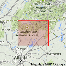
Type locality: exposures in large hydraulic cut near the inactive Barlow Mine (gold mine) near Dahlonega, Dawsonville and Campbell Mountain 7.5-min quadrangles, Lumpkin Co., north-central GA.
Source: US geologic names lexicon (USGS Bull. 1565, p. 21).
For more information, please contact Nancy Stamm, Geologic Names Committee Secretary.
Asterisk (*) indicates published by U.S. Geological Survey authors.
"No current usage" (†) implies that a name has been abandoned or has fallen into disuse. Former usage and, if known, replacement name given in parentheses ( ).
Slash (/) indicates name conflicts with nomenclatural guidelines (CSN, 1933; ACSN, 1961, 1970; NACSN, 1983, 2005, 2021). May be explained within brackets ([ ]).