The National Geologic Map Database is migrating to a new infrastructure. We apologize for any service disruptions during this process.
|
|---|


- Usage in publication:
-
- Barley Mill Gneiss
- Modifications:
-
- Original reference
- Dominant lithology:
-
- Gneiss
- AAPG geologic province:
-
- Piedmont-Blue Ridge province
Summary:
Pg. 14-15; W.S. Schenck and others, 2000, Delaware Geol. Survey, Geol. Map. Ser., no. 10, scale 1:36,000. Barley Mill Gneiss of Wilmington Complex. Coarse-grained, foliated tonalite gneiss with or without mafic enclaves and amphibolite. Major minerals are biotite, hornblende, plagioclase, and quartz. Previously included in James Run Formation. Intrudes Faulkland Gneiss of Wilmington Complex, and Wissahickon Formation. Several inclusions of biotite gneiss within the Barley Mill near the contact with the Wissahickon are interpreted to be xenoliths of country rock. Composition and textures suggest the Barley Mill is a pluton rather than a sedimentary melange as interpreted by some previous workers. Absence of pyroxene indicates amphibolite-facies metamorphism. Zircons from a sample of tonalitic gneiss (locality Bc53-k) yielded a U-Pb age of 470 +/-9 Ma (J.N. Aleinikoff, USGS, personal commun., 2000). [Age is considered Early to Middle Ordovician; the Early/Middle Ordovician boundary is approx. 470 Ma.]
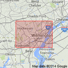
Type section [composite]: two localities near Tatnall School, north of community of Sedgley Farms, Wilmington North 7.5-min quadrangle, New Castle Co., DE; (1) on south side of Barley Mill Road at intersection with road to school, Lat. 39 deg. 46 min. 16 sec. N., Long. 75 deg. 36 min. 40 sec., W., and (2) on west side of pond, south of Barley Mill Road, east of Tatnall School, Lat. 39 deg. 46 min. 01 sec. N., Long. 75 deg. 36 min. 40 sec., W. Origin of name not stated by authors, but probably named from Barley Mill Road.
Source: Publication.
For more information, please contact Nancy Stamm, Geologic Names Committee Secretary.
Asterisk (*) indicates published by U.S. Geological Survey authors.
"No current usage" (†) implies that a name has been abandoned or has fallen into disuse. Former usage and, if known, replacement name given in parentheses ( ).
Slash (/) indicates name conflicts with nomenclatural guidelines (CSN, 1933; ACSN, 1961, 1970; NACSN, 1983, 2005, 2021). May be explained within brackets ([ ]).