


- Usage in publication:
-
- Banner Formation
- Modifications:
-
- Named
- Dominant lithology:
-
- Till
- AAPG geologic province:
-
- Illinois basin
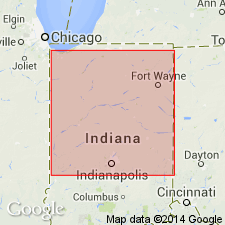
Summary:
Banner Formation named in north-central IL. Till consists 90 m of glacial outwash deposit. Subdivided Harkness Silt Member, Lierle Clay Member (west), Sankoty Sand Member, and Mahomet Sand Member (central). Overlies Enion Formation. Age is Pleistocene (Kansan).
Source: GNU records (USGS DDS-6; Reston GNULEX).
- Usage in publication:
-
- Banner Formation
- Modifications:
-
- Revised
- AAPG geologic province:
-
- Illinois basin
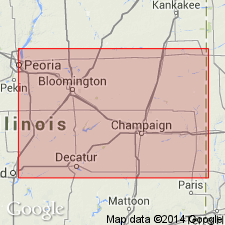
Summary:
West Lebanon Till Member of Banner Formation, here newly defined in west-central IN, described as reddish, smectitic, silty clay loam- to sandy loam-textured diamicts that contain clasts of red claystones. Is oldest known till in IN and underlies Harmattan Till Member of Banner. Mahomet Member and newly named Blackford Member assigned in this report to the Banner Formation in western IN and to the Jessup Formation to the east. Blackford Member consists of stratified clays and silts in its lacustrine facies and sand, gravel, and till in its eastern and western ice-proximal facies. Age of the Banner is pre-Illinoian.
Source: GNU records (USGS DDS-6; Reston GNULEX).
- Usage in publication:
-
- Banner Formation
- Modifications:
-
- Revised
- Overview
- AAPG geologic province:
-
- Illinois basin
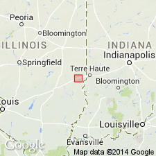
Summary:
Mahomet Sand Member of the Banner Formation is restricted to the Mahomet and Kenney bedrock valleys of IL. Unit is here revised to include a silt facies in tributary valleys and locally in the main valley. As here defined, therefore, Mahomet consists of a coarse, gravelly sand facies found primarily in the main valley and an interfingering silt facies, which consists of calcareous silt and clay. Sand facies averages more than 30 m and reaches a maximum of 45 m. Silt facies is locally greater than 12 m. Mahomet Sand Member is equivalent to and correlates, at least in part, with Sankoty Sand Member of Banner Formation, which is restricted to the Mackinaw Valley. Probably also correlates with the Hegeler and Belgium Members of the Banner, which are restricted to an upland bedrock valley near Danville (Johnson, 1971: IL Circ. 457). Silt facies underlies Harmattan Till Member and overlies a red till that may correlate with the West Lebanon Till Member (Bleuer, this volume) of IN. Sand facies underlies Glasford Formation. Age is pre-Illinoian.
Source: GNU records (USGS DDS-6; Reston GNULEX).
- Usage in publication:
-
- Banner Formation
- Modifications:
-
- Overview
- AAPG geologic province:
-
- Illinois basin
Summary:
Banner Formation is the oldest known Quaternary lithostratigraphic unit in Clark Co. Less than 2 ft thick at the Martinsville site, but more than 30 ft thick elsewhere. Includes two members in the study area: the informal Casey till member (Ford, 1970) and the overlying Lierle Clay Member. (The Casey was correlated with the Hillery Till Member by Kettles (1980), but authors prefer to use Ford's local nomenclature.) The Casey is composed of gray loam to clay loam diamicton and contains abundant wood fragments. The Lierle is composed of soft, leached clay and silty clay diamicton. Yarmouth Soil is developed in the upper part of the Banner. Unit has been dated at 788 to 302 ka by Richmond and Fullerton (1986).
Source: GNU records (USGS DDS-6; Reston GNULEX).
For more information, please contact Nancy Stamm, Geologic Names Committee Secretary.
Asterisk (*) indicates published by U.S. Geological Survey authors.
"No current usage" (†) implies that a name has been abandoned or has fallen into disuse. Former usage and, if known, replacement name given in parentheses ( ).
Slash (/) indicates name conflicts with nomenclatural guidelines (CSN, 1933; ACSN, 1961, 1970; NACSN, 1983, 2005, 2021). May be explained within brackets ([ ]).