

- Usage in publication:
-
- Bangor limestone*
- Modifications:
-
- Original reference
- Dominant lithology:
-
- Limestone
- Shale
- Dolostone
- AAPG geologic province:
-
- Appalachian basin (Eastern Overthrust area)
Summary:
Pg. 155-157 and map. The sub-Carboniferous of Alabama is divided into "Upper or Calcareous member (named Oxmoor sandstone and shales and Bangor limestone)" and "Lower or Siliceous member (named Fort Payne chert)." The upper calcareous member is variable in composition. In north Alabama it is chiefly a limestone called Mountain limestone, from fact it forms flanks of most mountains in that section that are capped by Coal Measures. Within this limestone there is interbedded a layer of sandstone [Hartselle] of variable thickness, perhaps 100 feet maximum in Tennessee Valley, while the over and underlying limestones are many times that. As we come southward the sandstone (which we have often called La Grange sandstone, but that name is preoccupied, which has caused us to replace it by name Oxmoor, where the rocks are well exposed and where the shales are more conspicuous than at La Grange) becomes more important, and lower section of the limestone appears to give way to, or to be replaced by, a series of black shales [Floyd shale] closely resembling those of the Devonian but many times more massive. The limestone which comes next below the Coal Measures is well exposed at many places, as at Bangor, Blount Springs, and Trussville, where it is extensively quarried, but south of latitude of Birmingham it is very rarely seen, and in its stead we find the black shales mentioned. These shales are often interstratified with dark-colored limestones and sometimes with tolerably pure limestones, but these are unimportant in thickness as compared with the shales and sandstones. The greater part of Shades Valley is based upon these sandstones and shales, though the limestone appears in several places.
Source: US geologic names lexicon (USGS Bull. 896, p. 109-110).

- Usage in publication:
-
- Bangor limestone*
- Modifications:
-
- Overview
- AAPG geologic province:
-
- Appalachian basin (Eastern Overthrust area)
Summary:
Bangor limestone of Chester group. Mapping by Charles Butts resulted in restriction (Alabama Geol. Survey Spec. Rpt., no. 14, 1926) of Bangor to the limestone above Hartselle sandstone and below Pennington shale. In Shades Valley the Bangor restricted is overlain by an upper tongue of Floyd shale. In the broad sense in which Bangor limestone was originally defined and subsequently used it included all Mississippian rocks above Fort Payne chert. In some early reports it was used to include the rocks later named Tuscumbia limestone, while in some other reports these rocks were included in Fort Payne chert. A name became necessary for the limestone above Hartselle sandstone, for which the name Bangor is especially appropriate, while the use of the name in the broad sense became unnecessary, the rocks having been subdivided. The Bangor restricted belongs to Chester group. (See also under Hartselle sandstone.)
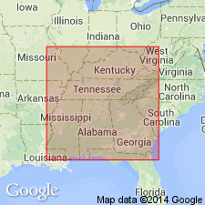
Named from development at Bangor, Blount Co., AL. Extends into central and eastern TN, and northwestern GA.
Source: US geologic names lexicon (USGS Bull. 896, p. 109-110).

- Usage in publication:
-
- Bangor limestone
- Modifications:
-
- Revised
- AAPG geologic province:
-
- Black Warrior basin
Summary:
Pg. 13-15. Bangor limestone. Includes Burgess oolite and Rockwood oolite. [Age is Late Mississippian.]
Source: US geologic names lexicon (USGS Bull. 1200, p. 209-210).
- Usage in publication:
-
- Bangor limestone
- Modifications:
-
- Revised
- AAPG geologic province:
-
- Black Warrior basin
Summary:
Pg. 575-578. Bangor limestone. Includes Spout Spring oolite (new) near base, a massive hard gray oolite, 50 feet thick, below Rockwood oolite member. Overlies Hartselle sandstone. [Age is Late Mississippian.]
Source: US geologic names lexicon (USGS Bull. 1200, p. 209-210); GNU records (USGS DDS-6; Reston GNULEX).
- Usage in publication:
-
- Bangor limestone*
- Modifications:
-
- Areal extent
- AAPG geologic province:
-
- Black Warrior basin
Summary:
Pg. 214, 242 (fig. 1). Bangor limestone. In Murphree Valley anticline, Bangor is fossiliferous cliff-making limestone about 600 feet thick. Underlies Pennington shale; overlies Tuscumbia limestone. Age is Late Mississippian.
Source: US geologic names lexicon (USGS Bull. 1200, p. 209-210).

- Usage in publication:
-
- Bangor Limestone*
- Modifications:
-
- Overview
- AAPG geologic province:
-
- Appalachian basin (Eastern Overthrust area)
- Black Warrior basin
Summary:
Pg. 24. Bangor Limestone. Medium- to medium-light-gray, medium-bedded, primarily bioclastic and oolitic limestone, locally including micrite, shaly argillaceous limestone, calcareous clay shale, and earthy dolostone. Interbeds of dusky-red and olive-green blocky mudstone occur in upper part of formation. Thickness 0 to 700 feet. Present in Appalachian Plateaus and the western Valley and Ridge. Age is Late Mississippian (Chesterian).
Source: Publication.
- Usage in publication:
-
- Bangor Limestone
- Modifications:
-
- Revised
- AAPG geologic province:
-
- Black Warrior basin
Summary:
A very thin extensive tongue of the middle Bangor Limestone in the Black Warrior basin is informally called the Millerella limestone. In MS, the Millerella tongue separates the Parkwood Formation into upper and lower units. The lower tongue of the Bangor is overlapped by a northeastward-prograding succession of deltaic sandstones and mudstones of the lower part of the Parkwood. The upper mudstones and sandstones of the Parkwood, which contain several thin tongues of limestone, grade northeastward into the upper part of the Bangor Limestone. The Mississippian-Pennsylvanian boundary is within the Parkwood above the Millerella. In the Cahaba synclinorium, the Bangor Limestone grades southwestward into the Floyd Shale.
Source: GNU records (USGS DDS-6; Reston GNULEX).
- Usage in publication:
-
- Bangor Limestone
- Modifications:
-
- Areal extent
- AAPG geologic province:
-
- Appalachian basin (Eastern Overthrust area)
Summary:
In northwestern GA, northeastern AL, and southeastern TN, Bangor Limestone caps a 300-450-m-thick Mississippian carbonate sequence. In northwestern GA, the Bangor is subdivided into carbonate-rich lower and upper members and a clastic-rich middle member, while correlative strata in west-central AL are assigned to the clastic Parkwood Formation. Unit comprises nine lithofacies: Bryozoan-Echinoderm wackestone/packstone/grainstone; oolitic packstone; oolitic grainstone; Foram-Ostracode wackestone; carbonate mudstone; dolomitic mudstone/wackstone; intraclastic packstone/grainstone; and terrigenous clastics. The Bangor was deposited in three broad environmental zones: 1) a low-energy open-marine shelf, 2) a high-energy ooid shoal, and 3) a low-energy back-shoal lagoon and tidal-flat complex. The middle late Chesterian Bangor Limestone overlies the "Hartselle Formation" and underlies the Pennington Formation.
Source: GNU records (USGS DDS-6; Reston GNULEX).
For more information, please contact Nancy Stamm, Geologic Names Committee Secretary.
Asterisk (*) indicates published by U.S. Geological Survey authors.
"No current usage" (†) implies that a name has been abandoned or has fallen into disuse. Former usage and, if known, replacement name given in parentheses ( ).
Slash (/) indicates name conflicts with nomenclatural guidelines (CSN, 1933; ACSN, 1961, 1970; NACSN, 1983, 2005, 2021). May be explained within brackets ([ ]).