

- Usage in publication:
-
- Bandera Quarry sandstone member
- Modifications:
-
- Overview
- AAPG geologic province:
-
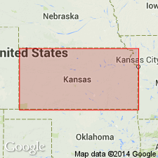
- Cherokee basin
Summary:
Pg. 292. Bandera Quarry sandstone member of Bandera shale. Name applied to sandstone lenses in the Bandera shale. [Age is Middle Pennsylvanian (Des Moines).]
Source: US geologic names lexicon (USGS Bull. 1200, p. 209).

- Usage in publication:
-
- Bandera Quarry sandstone member
- Modifications:
-
- Overview
- Dominant lithology:
-
- Sandstone
- AAPG geologic province:
-
- Cherokee basin
Summary:
Pg. 196. Bandera Quarry sandstone member of Bandera shale. Gray and brown sandstone, generally thin bedded, locally "flagstones"; lenticular. Thickness as much as 30 feet; average 15 feet. Age is Middle Pennsylvanian (Desmoinesian).
Source: US geologic names lexicon (USGS Bull. 1200, p. 209); supplemental information from GNU records (USGS DDS-6; Denver GNULEX).

- Usage in publication:
-
- Bandera Quarry sandstone member
- Modifications:
-
- Areal extent
- AAPG geologic province:
-
- Cherokee basin
Summary:
Pg. 35, 37, 38, pl. 3. Bandera Quarry sandstone member of Bandera shale. Sandstone is commonly well bedded and is fine and micaceous; locally the sandstone occupies entire Bandera section; where present, it is generally separated by shale ranging in thickness from a few feet to 20 or more feet. [Age is Middle Pennsylvanian (Des Moines).]
Source: US geologic names lexicon (USGS Bull. 1200, p. 209).
- Usage in publication:
-
- Bandera Quarry sandstone member
- Modifications:
-
- Areal extent
- AAPG geologic province:
-
- Cherokee basin
Summary:
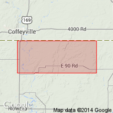
Pg. 132 (fig. 2), 136-137. Bandera Quarry sandstone member of Bandera shale. Geographically extended into Nowata and Craig Counties, Oklahoma, where it occurs near top of Bandera shale, about 10 feet below base of the Altamont. A channel filling; most exposures show even bedding that is continuous for many miles. Locally contains thin shale members. Thickness of sandstone group is 11 feet. [Age is Middle Pennsylvanian (Des Moines).]
Source: US geologic names lexicon (USGS Bull. 1200, p. 209).
For more information, please contact Nancy Stamm, Geologic Names Committee Secretary.
Asterisk (*) indicates published by U.S. Geological Survey authors.
"No current usage" (†) implies that a name has been abandoned or has fallen into disuse. Former usage and, if known, replacement name given in parentheses ( ).
Slash (/) indicates name conflicts with nomenclatural guidelines (CSN, 1933; ACSN, 1961, 1970; NACSN, 1983, 2005, 2021). May be explained within brackets ([ ]).