The National Geologic Map Database is migrating to a new infrastructure. We apologize for any service disruptions during this process.
|
|---|


- Usage in publication:
-
- Bandelier rhyolite tuff
- Modifications:
-
- Original reference
- Dominant lithology:
-
- Tuff
- AAPG geologic province:
-
- San Juan basin
Summary:
Geol. map; see also 1937 [abs.], GSA Proc. 1936, p. 103. Bandelier rhyolite tuff. Named as sixth in a list of seven Quaternary formations in area. Older than Santa Clara basalt (new); locally overlies Puye gravel (new). Age is Quaternary.
[Type locality not designated.] Occurs in Abiquiu quadrangle, Rio Arriba Co., north-central NM.
Source: US geologic names lexicon (USGS Bull. 1200, p. 208); supplemental information from GNU records (USGS DDS-6; Denver GNULEX).
- Usage in publication:
-
- Bandelier tuff*
- Modifications:
-
- Age modified
- AAPG geologic province:
-
- Orogrande basin
Summary:
Pg. 114 (fig. 14). Age is Pleistocene.
[Misprint (USGS Bull. 1200, p. 208): Caswell Cooper listed as 2nd author; should be Caswell Silver.]
Source: Publication; US geologic names lexicon (USGS Bull. 1200, p. 208).
- Usage in publication:
-
- Bandelier rhyolite tuffs*
- Modifications:
-
- Revised
- AAPG geologic province:
-
- San Juan basin
Summary:
Bandelier revised--divided into "upper" and "middle" members, with Santa Clara pumice bed at base of "middle" member in Jemez Mountains, Bandelier National Park, Los Alamos Co, NM in San Juan basin. The "middle" member, consisting of pumiceous tuff, tuff breccia, and pumice is from a few ft to 220 ft thick. Basal portion of this member is an apron of explosive rhyolite debris which nearly surrounds the eroded older "Chicoma" volcanics and consists of pumice and pumice gravel locally known as the "Santa Clara pumice bed" and locally more than 100 ft thick [Santa Clara pumice bed probably not a good unit--not used by anyone else]. "Upper" member, composed of crystal tuff and tuff breccia, ranges in thickness from about 200 ft on the east to about 1,000 ft in Upper Frijoles Canyon. A section 404 ft thick measured in Los Alamos Canyon. Is of Pleistocene age.
Source: GNU records (USGS DDS-6; Denver GNULEX).
- Usage in publication:
-
- Bandelier Tuff*
- Modifications:
-
- Redescribed
- Revised
- Dominant lithology:
-
- Tuff
- Pumice
- Ash
- AAPG geologic province:
-
- San Juan basin
Summary:
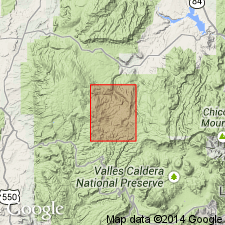
"Bandelier Rhyolite Tuff" was used for map unit in Abiquiu quad north of Los Alamos area by Smith (1938), not defined or described, and simply listed as Quaternary. Probably named from exposures in Bandelier National Monument, Sandoval Co, NM in San Juan basin. Is the thick unit of rhyolite tuff that caps much of Pajarito Plateau from Sierra de los Valles eastward to White Rock Canyon; forms spectacular cliffs along east-west and southeast-northwest-trending canyons of the plateau. Overlies Tschicoma Formation with erosional unconformity. Is thickest near western margin of the plateau, where 1,050 ft; thins rapidly as it laps onto Tschicoma Formation. Also thins to east. Many deep canyons cut into it in northeast. Name shortened to Bandelier Tuff, adopted by the USGS, assigned as a formation of Tewa Group (new), and divided into three mappable members in this report. Lowest part composed mainly of unconsolidated pebble-sized pumice (here named Guaje Member); middle part is a massive aggregate of poorly sorted, pumiceous rhyolite tuff breccia (here named Otowi Member); and upper unit is cliff-forming welded rhyolite tuff (here named Tshirege Member). No type specified by Smith. Type section specified only for Guaje in this report; type areas for other two members. Measured sections, geologic map, and chart showing stratigraphic relations of map units. Is of Pleistocene age, probably as young as middle Pleistocene.
Source: GNU records (USGS DDS-6; Denver GNULEX).
- Usage in publication:
-
- Bandelier Tuff*
- Modifications:
-
- Areal extent
- AAPG geologic province:
-
- San Juan basin
Summary:
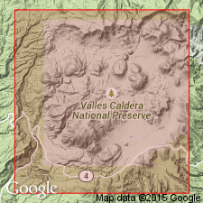
Follows Ross and others (1961), and recognizes two informal members of Bandelier Tuff in Jemez Mountains, northern NM in San Juan basin--they are designated simply upper and lower members. Lower member was erupted approximately 1.4 m.y. ago, was followed by subsidence in its source area to form Toledo caldera; upper member was erupted approximately 1.0 m.y. ago, and formed Valles caldera (K-Ar ages from Dalrymple, personal communication with author). Correlation of nearly 100 detailed stratigraphic sections has permitted recognition of five informal subunits (groups of ash flows), identified by relative emplacement-temperature characteristics, and by mineralogy. These are designated I, II, III, IV, and V, and are discussed at length. Bandelier forms broad plateaus that slope radially from Jemez Mountains volcanic highland; plateaus are dissected by numerous deep canyons, where hundreds of miles of exposures occur. Present outcrop area of ash-flow sheets is about 500 sq mi. In interval between upper and lower Bandelier eruptions, lower member was extensively eroded and deeply incised radial canyons were carved. Upper member was emplaced on the much dissected topography. Ash-flow eruptions were preceded by pumice falls; pumice deposits present everywhere beneath the ash-flow sheets. Is of Pleistocene age.
Source: GNU records (USGS DDS-6; Denver GNULEX).
- Usage in publication:
-
- Bandelier Tuff*
- Modifications:
-
- Geochronologic dating
- Paleomagnetics
- AAPG geologic province:
-
- San Juan basin
Summary:
Informal upper and lower members of Bandelier Tuff (following usage of Smith and Bailey, 1966) dated by K-Ar method on anorthoclase and sanidine samples taken in Valles caldera, Jemez Mountains, Sandoval Co, NM in San Juan basin. Lower member--called the Otowi Member and underlying Guaje Member by Griggs (1964)--dated on sanidine as 1.4 m.y. old. Upper member--called the Tshirege Member by Griggs (1964) --dated on anorthoclase and sanidine as 1.0 m.y. old. Has reversed magnetic polarity. Is of early Pleistocene age.
Source: GNU records (USGS DDS-6; Denver GNULEX).
- Usage in publication:
-
- Bandelier Tuff*
- Modifications:
-
- Revised
- AAPG geologic province:
-
- San Juan basin
Summary:
Bandelier Tuff of Tewa Group, previously divided informally into "upper" and "middle" members, with Santa Clara Pumice Bed at base of "middle" member, revised and divided into two formal members: 1) Otowi Member (at base), whose lower contact is extended to include the basal pumice fall, Guaje Member of Griggs (reduced in rank to Guaje Pumice Bed) and the overlying unnamed ash-flow units (Otowi Member of Griggs); and 2) Tshirege Member (at top), which includes a basal pumice fall, named Tsankawi Pumice Bed (new), and the overlying unnamed ash-flow units (Tshirege Member of Griggs). Ash-flow units not formally named in either member. Is in Jemez Mountains, Sandoval Co, NM in San Juan basin.
Source: GNU records (USGS DDS-6; Denver GNULEX).
- Usage in publication:
-
- Bandelier Tuff*
- Modifications:
-
- Paleomagnetics
- AAPG geologic province:
-
- San Juan basin
Summary:
A rhyolite volcanic ash bed about 1 ft thick is exposed in a roadcut along TX Hwy 193 in upper part of sequence of lower Pleistocene sedimentary deposits at type locality of Blanco Formation about 37 mi northeast of Lubbock, TX, in Permian basin. This ash has chemical and petrographic characteristics matching the rhyolite air-fall tephra (Pleistocene Guaje Pumice Bed of Otowi Member of Bandelier Tuff) that immediately underlies unnamed ash flows of Otowi in the Jemez Mountains of northern NM, in San Juan basin. Composition of glass phase of the ash matches that of Guaje for all major elements (except K and Na). Paleomagnetic measurements indicate that the ash has reverse remanent magnetization. Sanidine from Guaje Pumice Bed and its genetically related overlying ash-flow sheet in Jemez Mountains has been K-Ar dated at about 1.4 m.y. by Doell and others (1968). Correlation of the ash bed near Mount Blanco, TX, with the Guaje has implications concerning the duration of the well-known Blancan Land Mammal age.
Source: GNU records (USGS DDS-6; Denver GNULEX).
- Usage in publication:
-
- Bandelier Tuff
- Modifications:
-
- Areal extent
- AAPG geologic province:
-
- San Juan basin
Summary:
Extended into Jarosa quad, Rio Arriba Co, NM in San Juan basin where Bandelier is one mapped unit (although others have distinguished two members as map units). Is 0-600 ft thick. Shown as overlying lower member of Abiquiu Formation [Tuff] locally on Mesa Pinabetosa in northeast part of quad. Underlies landslide deposits, mostly large, angular blocks derived from Bandelier Tuff. Is of Pleistocene age.
Source: GNU records (USGS DDS-6; Denver GNULEX).
- Usage in publication:
-
- Bandelier Tuff*
- Modifications:
-
- Geochronologic dating
- Age modified
- AAPG geologic province:
-
- Estancia basin
- Palo Duro basin
- Permian basin
- San Juan basin
- San Luis basin
Summary:
Pg. 38 (fig. 11), 39 (table 10), 40 (table 11). Bandelier Tuff. Reported K-Ar ages of Doell and others (GSA Mem. 116, 1968) are recalculated using new decay constants of Steiger and Jager (1977), ascending:
(1) Otowi Member: Guaje Pumice Bed, 1.4 +/-0.04 Ma; overlying ash flows, 1.48 +/-0.04 Ma and 1.52 +/-0.09 Ma.
(2) Tshirege Member: Tsankawi Pumice Bed, 1.12 +/-0.03 Ma; overlying ash flows, 1.02 +/-0.04 Ma and 1.05 +/-0.04 Ma.
Notable localities in eastern Jemez Mountains, north-central NM, and southern High Plains, eastern NM and panhandle of TX (Bernalillo, DeBaca, Santa Fe, Taos, and Valencia Cos., NM, and Crosby and Lubbock Cos., TX).
Source: Publication.
- Usage in publication:
-
- Bandelier Tuff*
- Modifications:
-
- Geochronologic dating
- Age modified
For more information, please contact Nancy Stamm, Geologic Names Committee Secretary.
Asterisk (*) indicates published by U.S. Geological Survey authors.
"No current usage" (†) implies that a name has been abandoned or has fallen into disuse. Former usage and, if known, replacement name given in parentheses ( ).
Slash (/) indicates name conflicts with nomenclatural guidelines (CSN, 1933; ACSN, 1961, 1970; NACSN, 1983, 2005, 2021). May be explained within brackets ([ ]).