

- Usage in publication:
-
- Balsora limestone
- Modifications:
-
- Original reference
- Dominant lithology:
-
- Limestone
- AAPG geologic province:
-
- Fort Worth syncline
Summary:
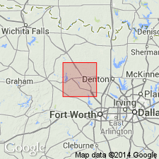
Pg. 24. Balsora limestone, in Palo Pinto formation, lies 70+/- feet below Bridgeport coal and 7 to 10 feet above Sanders Bridge limestone. Thickness 0 to 4+/- feet. Named from outcrop in valley of a small stream 1 mile west of Balsora, Wise County, north-central Texas. Also occurs along Boone Creek. To northeast it lesnses out into shales. Not present in section exposed at Martin Lake. Age is Pennsylvanian.
Source: US geologic names lexicon (USGS Bull. 896, p. 106).
For more information, please contact Nancy Stamm, Geologic Names Committee Secretary.
Asterisk (*) indicates published by U.S. Geological Survey authors.
"No current usage" (†) implies that a name has been abandoned or has fallen into disuse. Former usage and, if known, replacement name given in parentheses ( ).
Slash (/) indicates name conflicts with nomenclatural guidelines (CSN, 1933; ACSN, 1961, 1970; NACSN, 1983, 2005, 2021). May be explained within brackets ([ ]).