- Usage in publication:
-
- Balls Bluff Siltstone*
- Modifications:
-
- Named
- Dominant lithology:
-
- Siltstone
- AAPG geologic province:
-
- Piedmont-Blue Ridge province
- Culpeper basin
Summary:
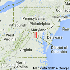
Calcisiltite with layers of limestone, dolomite, and sandstone exposed at Balls Bluff National Cemetery, Loudoun Co., VA, is here named Balls Bluff Siltstone of the Newark Group. It overlies the Manassas Sandstone; underlies and intertongues with the Leesburg Limestone Conglomerate Member of the Bull Run Formation. Thickness at type section is 131 ft (39.5 m). Age is Late Triassic and Early Jurassic(?).
Source: GNU records (USGS DDS-6; Reston GNULEX).
- Usage in publication:
-
- Balls Bluff Siltstone*
- Modifications:
-
- Revised
- Biostratigraphic dating
- AAPG geologic province:
-
- Piedmont-Blue Ridge province
- Culpeper basin
Summary:
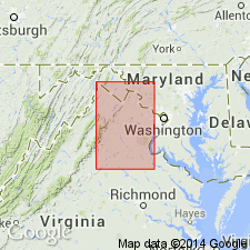
The Balls Bluff Siltstone is revised and assigned to the Culpeper Group. It constitutes the bulk of the Upper Triassic rocks in the central Culpeper and Barboursville basins and contains the redefined Leesburg Member in the northwestern Culpeper basin. It consists of grayish and dusky-red calcareous siltstone with thin layers of gray limestone, dolomite, and fossiliferous and palyniferous gray to black mudstone and greenish-gray shale. Gradationally overlies the Manassas Sandstone; gradationally underlies the Catharpin Creek Formation on the west side of the Culpeper basin and the Tibbstown Formation in the Barboursville basin. Thickness ranges from 260 to 5,500 ft (80 to 1,690 m). Age is late Carnian to late Norian based on palynoflora. Freshwater invertebrates, fish teeth and scales, and dinosaur tracks and bones are present locally.
Source: GNU records (USGS DDS-6; Reston GNULEX).
- Usage in publication:
-
- Balls Bluff Siltstone*
- Modifications:
-
- Age modified
- Biostratigraphic dating
- AAPG geologic province:
-
- Piedmont-Blue Ridge province
- Barboursville basin
- Culpeper basin
Summary:
Palynological study of the Manassas Sandstone, which underlies the Balls Bluff Siltstone, indicates that the Manassas is of Carnian and early Norian age. This conclusion makes the Balls Bluff of Norian age only.
Source: GNU records (USGS DDS-6; Reston GNULEX).
- Usage in publication:
-
- Balls Bluff Siltstone*
- Modifications:
-
- Biostratigraphic dating
- AAPG geologic province:
-
- Piedmont-Blue Ridge province
- Culpeper basin
Summary:
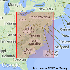
A new palynomorph species, FROELICHSPORITES TRAVERSEI, occurs throughout Newark Supergroup of eastern United States and Canada, Dockum Group of TX and NM, and Chinle Formation of NM, AZ, and UT. It is restricted geologically to strata deposited during upper Carnian and Norian Stages of the Upper Triassic. It occurs in the following formations of the Newark Supergroup: Passaic Formation (NJ), Gettysburg Formation (PA and MD), Manassas Sandstone (MD), Balls Bluff Siltstone (VA), Cow Branch Formation (NC), and Stoneville Formation (NC).
Source: GNU records (USGS DDS-6; Reston GNULEX).
- Usage in publication:
-
- Balls Bluff Siltstone*
- Modifications:
-
- Age modified
- Biostratigraphic dating
- AAPG geologic province:
-
- Piedmont-Blue Ridge province
- Culpeper basin
Summary:
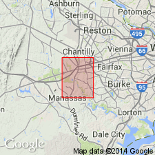
Balls Bluff Siltstone is uppermost unit of Culpeper Group present in Manassas quad. Pollen grains collected from Balls Bluff indicate a Late Triassic age, ranging from early to late Norian (R.J. Litwin, 1991, oral commun.), although lowest part of unit has been interpreted previously as possibly late Carnian (Lee and Froelich, 1989; Luttrell, 1989).
Source: GNU records (USGS DDS-6; Reston GNULEX).
For more information, please contact Nancy Stamm, Geologic Names Committee Secretary.
Asterisk (*) indicates published by U.S. Geological Survey authors.
"No current usage" (†) implies that a name has been abandoned or has fallen into disuse. Former usage and, if known, replacement name given in parentheses ( ).
Slash (/) indicates name conflicts with nomenclatural guidelines (CSN, 1933; ACSN, 1961, 1970; NACSN, 1983, 2005, 2021). May be explained within brackets ([ ]).

