The National Geologic Map Database is migrating to a new infrastructure. We apologize for any service disruptions during this process.
|
|---|


- Usage in publication:
-
- Ball Mountain Formation
- Modifications:
-
- Original reference
- Dominant lithology:
-
- Graywacke
- Quartzite
- Siltstone
- Mudstone
- Schist
- AAPG geologic province:
-
- Piedmont-Blue Ridge province
Summary:
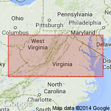
The Ball Mountain Formation of the Lynchburg Group, here named, is in the Culpeper and Rockfish River areas in Virginia. Consists of coarse-grained to pebbly quartz wacke and quartzite interbedded with laminated siltstone and graphitic mudstone. The upper 100 m consists of graphitic schist named the Johnson Mill Member, the revised Johnson Mill Formation of Nelson (1962). Truncates underlying units and either unconformably overlies or is in fault contact with the Thorofare Mountain Formation (new name) of the Lynchburg. Is in fault(?) contact with the overlying Charlottesville Formation. Is equivalent to the upper part of the Rockfish Conglomerate. Age is Late Proterozoic based on an age of 730 to 570 Ma for the Lynchburg Group.
Type locality: exposures on Ball Mountain south of the Rockfish River, Schuyler 7.5-min quadrangle, Nelson Co., VA.
Source: US geologic names lexicon (USGS Bull. 1565, p. 19).
- Usage in publication:
-
- Ball Mountain Formation
- Modifications:
-
- Areal extent
- AAPG geologic province:
-
- Piedmont-Blue Ridge province
Summary:
Use of the name Swift Run Formation should be restricted to the western limb of the Blue Ridge anticlinorium. Rocks on the east limb of the Blue Ridge anticlinorium in northern VA are here tentatively mapped as Ball Mountain Formation of Wehr (1985).
Source: GNU records (USGS DDS-6; Reston GNULEX).
- Usage in publication:
-
- Ball Mountain Formation*
- Modifications:
-
- Revised
- AAPG geologic province:
-
- Piedmont-Blue Ridge province
Kasselas, G.D., 1993, Stratigraphic framework, structural evolution and tectonic implications of the eastern Blue Ridge sequence in the central Appalachians near Warrenton, Virginia: Virginia Polytechnic Institute and State University, Department of Geological Sciences M.S. thesis, __ p.
Summary:
Wehr (1985) traced Ball Mountain Formation of Lynchburg Group as far north as Rappahannock River in north-central VA. The Ball Mountain in this report is mapped and revised to include rocks that underlie Catoctin Formation in area south of Rappahannock River which Wehr (1985) mapped as Swift Run(?) Formation. Rocks of Swift Run's type locality do not match these rocks lithologically. Charlottesville Formation as mapped by Wehr (1983, unpub. Ph.D dissert.) farther south in Culpeper area pinches out to the north; rocks mapped as Swift Run(?) Formation by Wehr (1983) probably pinch out to the north as well, or are equivalent to upper part of Ball Mountain Formation. Thickness varies from 200 to 550 m and pinches out abruptly north of Rappahannock River. Base is not clearly defined in Warrenton area, but is believed to be a continuous deposition above Monumental Mills Formation; conformably underlies Catoctin Formation. Divided into four facies: mudstone-siltstone; black shale; sandstone; and granule and pebble conglomerate.
Source: GNU records (USGS DDS-6; Reston GNULEX).

- Usage in publication:
-
- Ball Mountain
- Modifications:
-
- Not used
- AAPG geologic province:
-
- Piedmont-Blue Ridge province
Summary:
As mapped here, the Charlottesville Formation of the Lynchburg Group in the Culpeper area includes in part the Ball Mountain Formation of Wehr (1985) and Kasselas (1993).
Source: GNU records (USGS DDS-6; Reston GNULEX).
- Usage in publication:
-
- Ball Mountain Formation*
- Modifications:
-
- Revised
- AAPG geologic province:
-
- Piedmont-Blue Ridge province
Summary:
Ball Mountain and Charlottesville Formations are the only two formations assigned to Lynchburg Group (revised). Ball Mountain includes the Johnson Mill Member at its top south of Charlottesville, VA, according to table 9. Report includes geologic maps, correlation chart, and isotopic data.
Source: GNU records (USGS DDS-6; Reston GNULEX).
For more information, please contact Nancy Stamm, Geologic Names Committee Secretary.
Asterisk (*) indicates published by U.S. Geological Survey authors.
"No current usage" (†) implies that a name has been abandoned or has fallen into disuse. Former usage and, if known, replacement name given in parentheses ( ).
Slash (/) indicates name conflicts with nomenclatural guidelines (CSN, 1933; ACSN, 1961, 1970; NACSN, 1983, 2005, 2021). May be explained within brackets ([ ]).