The National Geologic Map Database is migrating to a new infrastructure. We apologize for any service disruptions during this process.
|
|---|


- Usage in publication:
-
- Baldy Peak glaciation
- Modifications:
-
- Named
- Dominant lithology:
-
- Till
- AAPG geologic province:
-
- Black Mesa basin
Summary:
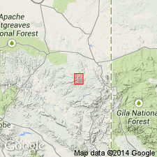
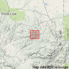
Named for the highest peak of the Mount Baldy Massif in the White Mountains of Apache Co, AZ in the Black Mesa basin. No type locality designated. Till of this glaciation is found in the upper reaches of the West Fork of the Black River, West Fork of the Little Colorado River, East Fork of the White River, and Ord Creek, all localities in the White Mountains. A higher and lower set of moraines on the Black River suggests two advances of the glaciation. A second advance of this glaciation also suggested by slight discordance of the moraines on the West Fork of the Colorado River. The moraines of Baldy Peak age are sharp crested. Some on the West Fork are as high as 30 m. Baldy Peak deposits are found only in the upper reaches of the valleys. Immature soils about 20-cm thick developed on the tills. Weathering rind is usually less than 0.5 cm thick. No pits developed on the erratics. A late Wisconsinan age suggested. Areal extent map. Is younger than the Smith Cienega glaciation (Named) and older than the Mount Ord glaciation (Named). Correlation chart.
Source: GNU records (USGS DDS-6; Denver GNULEX).
- Usage in publication:
-
- Baldy Peak glaciation
- Modifications:
-
- Overview
- AAPG geologic province:
-
- Black Mesa basin
Summary:
Baldy Peak till consists of sandy-gravel or gravelly-sand. It is very poorly sorted, positively skewed, and platykurtic. The boulders occur in profusion in sparsely vegetated areas; the degree of weathering on them is extremely minor, usually less than 1 cm deep; no pits have developed on them. Soils are poorly on Baldy Peak moraines. The moraines are steep, sharp crested, may be in multiple, and have kettles preserved on them. Evidence for two advances. Snowline was at an elevation of 10,700 to 10,900 feet. Deposits of this glaciation are in the upper reaches of West Fork of Black River, West Fork of Little Colorado River, East Fork of White River, and Ord Creek, White Mountains area, Apache Co, AZ in the Black Mesa basin. The characteristics of the moraines and the erratics suggest very late Wisconsinan age.
Source: GNU records (USGS DDS-6; Denver GNULEX).
For more information, please contact Nancy Stamm, Geologic Names Committee Secretary.
Asterisk (*) indicates published by U.S. Geological Survey authors.
"No current usage" (†) implies that a name has been abandoned or has fallen into disuse. Former usage and, if known, replacement name given in parentheses ( ).
Slash (/) indicates name conflicts with nomenclatural guidelines (CSN, 1933; ACSN, 1961, 1970; NACSN, 1983, 2005, 2021). May be explained within brackets ([ ]).