The National Geologic Map Database is migrating to a new infrastructure. We apologize for any service disruptions during this process.
|
|---|


- Usage in publication:
-
- Bald Peak basalt*
- Modifications:
-
- Original reference
- Dominant lithology:
-
- Basalt
- AAPG geologic province:
-
- Sacramento basin
Summary:
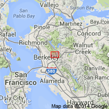
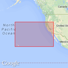
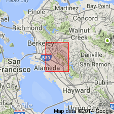
Map at end. Bald Peak basalt. Top formation of Berkeleyan series [Berkeley group]. Forms large part of Bald Peak [now called Vollmer Peak] east of Berkeley, [in T. 1 N., R. 3 W., Lat. 37 deg. 53 min. 00 sec. N., Long. 122 deg. 13 min. 19 sec. W., southwestern corner Briones Valley 7.5-min quadrangle, Contra Costa Co.], San Francisco region, western CA. Age is Pliocene.
Source: US geologic names lexicon (USGS Bull. 896, p. 105); supplemental information from GNU records (USGS DDS-6; Menlo GNULEX).
- Usage in publication:
-
- Bald Peak basalt*
- Modifications:
-
- Adopted
- Mapped
- AAPG geologic province:
-
- Sacramento basin
Summary:
Bald Peak basalt of Berkeley group. Lava flows with lentils of fresh-water limestone; some dikes are included in mapping. Maximum thickness 300 to 350 feet; exposures are erosional residue of original flows. Overlies Siesta formation of Berkeley group. Age is Pliocene.
Mapped along San Pablo Ridge, western edge Concord 15-min quadrangle. Named from Bald Peak, [now called Vollmer Peak, in T. 1 N., R. 3 W., Lat. 37 deg. 53 min. 00 sec. N., Long. 122 deg. 13 min. 19 sec. W., southwestern corner Briones Valley 7.5-min quadrangle, Contra Costa Co.], Contra Costa Co., western CA.
Source: US geologic names lexicon (USGS Bull. 896, Berkeley entry p. 166); GNU records (USGS DDS-6; Menlo GNULEX).
- Usage in publication:
-
- Bald Peak formation
- Modifications:
-
- Age modified
- Redescribed
- AAPG geologic province:
-
- Sacramento basin
Summary:
Pg. 1511. Bald Peak formation included in sequence of formations (in west-central Contra Costa County) for which a new group name is proposed [name not given]. Sequence (ascending): (1) Orinda formation, Miocene and Pliocene flood-plain deposits; (2) Moraga formation, lower Pliocene volcanic and interbedded nonmarine sedimentary rocks; (3) Siesta formation, lower Pliocene lake beds; (4) Bald Peak formation, lower to middle(?) Pliocene volcanic rocks and lacustrine sedimentary rocks; and (5) unnamed formation (originally mapped as the Orinda but separate name is warranted; this new unit is exposed east of Moraga fault system, in fault contact with Siesta and Moraga formations).
Source: US geologic names lexicon (USGS Bull. 1200, p. 203); GNU records (USGS DDS-6; Menlo GNULEX).
- Usage in publication:
-
- Bald Peak formation
- Modifications:
-
- Revised
- AAPG geologic province:
-
- Northern Coast Range province
- Sacramento basin
Summary:
Pg. 15. Bald Peak formation of Contra Costa group. Included in Contra Costa group (new).
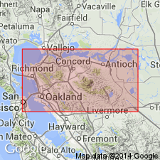
Area of study east of Oakland in Las Trampas Ridge area, Las Trampas Ridge 7.5-min quadrangle, Alameda and Contra Costa Cos., western CA.
Source: US geologic names lexicon (USGS Bull. 1200, p. 203).
- Usage in publication:
-
- Bald Peak basalts
- [Bald Peak Basalt*]
- Modifications:
-
- Age modified
- Geochronologic dating
- AAPG geologic province:
-
- Sacramento basin
Summary:
Pg. 188. Bald Peak basalts [Bald Peak Basalt]. Sample of olivine basalt (KA 1003) collected from Bald Peak Basalt on Bald Peak, Berkeley Hills, California, yielded a radiometric (K-Ar) age of 7.7 Ma (latest Clarendonian or early Hemphillian NALMA). Age is "questionable because of chlorite and inclusions. Age obtained will certainly be only a minimum figure."
(GNU remark, May 19, 1992: age of the Bald Peak Basalt and entire Contra Costa Group is Miocene on basis of Berggren's time scale [1985?] which places Miocene-Pliocene boundary at 5.3 Ma.)
Source: Publication; GNU records (USGS DDS-6; Menlo GNULEX); GNC index card files (USGS-Menlo)
- Usage in publication:
-
- Bald Peak Basalt*
- Modifications:
-
- Revised
- Adopted
- AAPG geologic province:
-
- Sacramento basin
Summary:
Pamphlet p. 6-7 (table 1); geol. map. Bald Peak Basalt of Contra Costa Group. Reassigned from †Berkeley Group (abandoned) to Contra Costa Group. Consists of basalt with minor amounts of sedimentary rocks. Large plagioclase phenocrysts are abundant. Fresh basalt is dark gray, weathering yellowish-gray. Typically cut by many intersecting fractures. Maximum thickness unknown. Conformably overlies the Siesta Formation. Forms moderately steep hillsides. Age is Pliocene.
Outcrop area very small, at north end of Siesta Valley, along northwestern border Oakland 7.5-min quadrangle, Contra Costa Co., western CA.
Source: Publication; Changes in stratigraphic nomenclature, 1967 (USGS Bull. 1324-A, p. A2); GNU records (USGS DDS-6; Menlo GNULEX).
For more information, please contact Nancy Stamm, Geologic Names Committee Secretary.
Asterisk (*) indicates published by U.S. Geological Survey authors.
"No current usage" (†) implies that a name has been abandoned or has fallen into disuse. Former usage and, if known, replacement name given in parentheses ( ).
Slash (/) indicates name conflicts with nomenclatural guidelines (CSN, 1933; ACSN, 1961, 1970; NACSN, 1983, 2005, 2021). May be explained within brackets ([ ]).