

- Usage in publication:
-
- Bakerstown sandstone
- Modifications:
-
- Areal extent
- Dominant lithology:
-
- Sandstone
- AAPG geologic province:
-
- Appalachian basin
Summary:
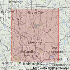
Pg. xix (preface) and 305-308, index. Bakerstown sandstone (in Conemaugh formation). Underlies Bakerstown coal and overlies Lower Barren Measure red shales, which rest on the Pine Creek coal. Age is Pennsylvanian. [Only recorded use of name.]
[Notable exposures in Allegheny Co., southwestern PA.]
Source: US geologic names lexicon (USGS Bull. 896, p. 103).
- Usage in publication:
-
- Bakerstown shale and sandstone member
- Modifications:
-
- Areal extent
- Revised
- AAPG geologic province:
-
- Appalachian basin
Summary:
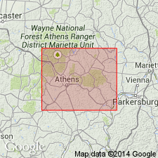
Pg. 95 (table 11), 120. Geographically extended into Athens County, Ohio, where it is called Bakerstown shale and (or) sandstone member of Anderson cyclothem in Conemaugh series. Lesley applied name in Pennsylvania to sandstone underlying Bakerstown (Anthony) coal and overlying Lower Barren Measure (Conemaugh) red shales, which rest on Pine Creek (Wilgus?) coal. Heretofore member bas been unnamed in Ohio or called Anderson as by Flint (1951, Ohio Geol. Survey, 4th ser., Bull. 48). In Athens County, Bakerstown member bas maximum and minimum thickness of 32 and 3 feet, respectively, with average thickness of 13 feet. Where underlying Cambridge and Wilgus members [of Wilgus cyclothem] are absent or indistinct and replaced by sandy and shaly bells, it is difficult to separate Bakerstown member from Buffalo member and undifferentiated Buffalo-Bakerstown shale and sandstone members attain considerable combined thickness. Stratigraphically below Bloomfield limestone member [of Anderson cyclothem]. Bloomfield member is well developed only in Muskingum County.
Source: US geologic names lexicon (USGS Bull. 1200, p. 197).
For more information, please contact Nancy Stamm, Geologic Names Committee Secretary.
Asterisk (*) indicates published by U.S. Geological Survey authors.
"No current usage" (†) implies that a name has been abandoned or has fallen into disuse. Former usage and, if known, replacement name given in parentheses ( ).
Slash (/) indicates name conflicts with nomenclatural guidelines (CSN, 1933; ACSN, 1961, 1970; NACSN, 1983, 2005, 2021). May be explained within brackets ([ ]).