

- Usage in publication:
-
- Baird shale
- Modifications:
-
- Named
- Dominant lithology:
-
- Shale
- AAPG geologic province:
-
- Klamath Mountains province
Summary:
Outcrops on west side of [McCloud] river just above Baird P.O., [Shasta Co, CA] where it is in places highly metamorphosed by dikes of diabase and diabase porphyrite. Consists of black siliceous shales, probably 500 feet thick. Two specimens of trilobites were obtained from dark calcareous shale four mi above [upstream]. A.W. Vogdes stated they were similar to PROETUS ELLIPTICUS from Lower Carboniferous of middle states.
Source: GNU records (USGS DDS-6; Menlo GNULEX).
- Usage in publication:
-
- Baird formation*
- Modifications:
-
- Adopted
- Revised
- Areal extent
- AAPG geologic province:
-
- Klamath Mountains province
Summary:
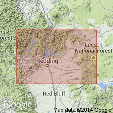
Baird formation [shale], as originally named by Prof. J.P. Smith (1904), included only fossiliferous upper portion. Here extended to include tuffaceous rocks and adjoining sandstones and shales which overlie Bragdon conglomerate. Baird formation extends northward in narrow belt up McCloud River for 12 mi and then passes into high hills west of river. Appears south of Gray Rock and as narrow belt extends along western border of McCloud limestone to Sacramento Valley. Thickness is at least 650 ft. Fauna (Smith, 1894, Journ. of Geol. v.2 p.595-597) is early Carboniferous age. Conformably overlies Bragdon formation; conformably underlies McCloud limestone. Mapped in Redding 30' quad.
Source: GNU records (USGS DDS-6; Menlo GNULEX).
- Usage in publication:
-
- Baird formation*
- Modifications:
-
- Age modified
- Biostratigraphic dating
- AAPG geologic province:
-
- Klamath Mountains province
Summary:
Presence of STAFFELLA? in beds few feet below contact of Baird formation with overlying McCloud limestone indicate that here topmost beds of Baird formation are at least Pennsylvanian and may be Permian in age.
Source: GNU records (USGS DDS-6; Menlo GNULEX).
- Usage in publication:
-
- Baird formation*
- Modifications:
-
- Principal reference
- AAPG geologic province:
-
- Klamath Mountains province
Summary:
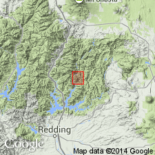
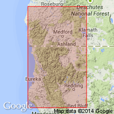
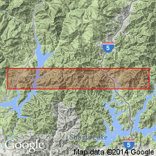
Named from exposures near now submerged Baird fish hatchery which was located on McCloud River near junction with Pit River [40 deg. 47'N, 122 deg 19'W, Lamoine 15' quad, Shasta Co, CA]. Earlier references, detailed lithology, lists of fauna with locations and ages, conditions of deposition are included in this paper. Age of middle part of Baird formation is Mississippian. On map of east Shasta copper-zinc district, Shasta Co, CA, distinct lithologies are shown where unit occurs along banks of McCloud River and Shasta Lake. Unconformably(?) underlies McCloud limestone (of Permian age). Overlies Bragdon formation (of Mississippian age).
Source: GNU records (USGS DDS-6; Menlo GNULEX).
- Usage in publication:
-
- Baird Shale*
- Modifications:
-
- Age modified
- Biostratigraphic dating
- AAPG geologic province:
-
- Klamath Mountains province
Summary:
Abundant shallow-water marine fossils from middle part of unit indicate Visean age; uppermost part contains Early Pennsylvanian fusulinids (Albers and Robertson, 1961; Skinner and Wilde, 1965). Age therefore is Mississippian and Early Pennsylvanian.
Source: GNU records (USGS DDS-6; Menlo GNULEX).
- Usage in publication:
-
- Baird Formation*
- Modifications:
-
- Age modified
- Revised
- AAPG geologic province:
-
- Klamath Mountains province
Summary:
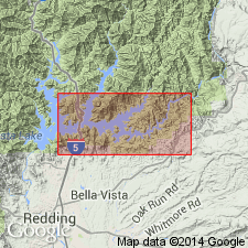
Name Hirz Mountain Limestone Member of Baird Formation is proposed for series of limestone lentils cropping out in sec.12-13 T35N, R4W and sec.18 T35N R3W, Lamoine 15' and Bollibokka Mountain 15' quads, Shasta Co, CA. Hirz Mountain Limestone Member has brachiopod DIPLANUS known from Upper Pennsylvanian and Lower Permian strata of Texas. "Because these upper Baird strata are underlain by Upper Pennsylvanian or Lower Permian rocks and overlain by rocks younger than basal Permian, they are probably at least in part of Permian age." Includes measured sections on Hirz Mountain and Kabyai Creek.
Source: GNU records (USGS DDS-6; Menlo GNULEX).
For more information, please contact Nancy Stamm, Geologic Names Committee Secretary.
Asterisk (*) indicates published by U.S. Geological Survey authors.
"No current usage" (†) implies that a name has been abandoned or has fallen into disuse. Former usage and, if known, replacement name given in parentheses ( ).
Slash (/) indicates name conflicts with nomenclatural guidelines (CSN, 1933; ACSN, 1961, 1970; NACSN, 1983, 2005, 2021). May be explained within brackets ([ ]).