

- Usage in publication:
-
- Badito formation*
- Modifications:
-
- Original reference
- Dominant lithology:
-
- Sandstone
- Conglomerate
- AAPG geologic province:
-
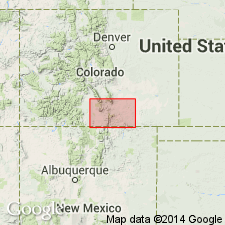
- Las Vegas-Raton basin
Summary:
Badito formation. Upper part consists of 100 feet of brick-red sandstone, massive or thick bedded but sometimes shaly on weathered sorface. This sandstone probably corresponds to some part of Fountain formation. Lower part consists of coarse brownish red conglomerate that is = Sangre de Cristo formation. Age is Pennsylvanian. [See also 1900 entry under Sangre de Cristo formation.]
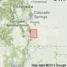
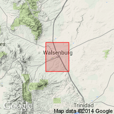
[Probably named from Badito Peak or town of Badito, just west of Walsenburg quadrangle and in Huerfano Park quadrangle, Walsenburg region, central southern CO.]
Source: US geologic names lexicon (USGS Bull. 896, p. 100).
- Usage in publication:
-
- Badito formation*
- Modifications:
-
- Overview
- AAPG geologic province:
-
- Las Vegas-Raton basin
Summary:
Name applied to the oldest nonmarine Pennsylvanian and Permian? rocks that crop out near Walsenburg on the flanks of the Greenhorn anticline and in the Cucharas River canyon 10 mi northeast of Walsenburg, Huerfano Co, CO in the Las Vegas-Raton basin. The Badito does not crop out in the area of the geologic map that accompanies this report. Rocks similar to the Badito are present in the Sangre de Cristo formation of the Sangre de Cristo Mountains. In a well northeast of Walsenburg, 109 ft of Badito rests on Precambrian schist. Rocks 100 to 5,000+ ft of Pennsylvanian age may be present in the subsurface. [No lithologic description of Badito included.]
Source: GNU records (USGS DDS-6; Denver GNULEX).
- Usage in publication:
-
- Badito Formation
- Modifications:
-
- Not used
Summary:
Exposures in the Cucharas River canyon area, northeast of Walsenburg, Huerfano Co, CO in the Las Vegas-Raton basin formerly assigned by Johnson (1958) to the Badito Formation are mapped as the Sangre de Cristo Formation of Pennsylvanian and Permian age. [No explanation for discontinued use of Badito given.]
Source: GNU records (USGS DDS-6; Denver GNULEX).
For more information, please contact Nancy Stamm, Geologic Names Committee Secretary.
Asterisk (*) indicates published by U.S. Geological Survey authors.
"No current usage" (†) implies that a name has been abandoned or has fallen into disuse. Former usage and, if known, replacement name given in parentheses ( ).
Slash (/) indicates name conflicts with nomenclatural guidelines (CSN, 1933; ACSN, 1961, 1970; NACSN, 1983, 2005, 2021). May be explained within brackets ([ ]).