- Usage in publication:
-
- Badger shale
- Modifications:
-
- Original reference
- Dominant lithology:
-
- Shale
- Graywacke
- AAPG geologic province:
-
- San Joaquin basin
Summary:
Pg. 7 (fig. 3), 9-12, pls. 1, 2. See also 1956 [abs.], Dissert. Abs., v. 16, no. 1, p. 101. Badger shale. Dark-green silty clay shale with gray buff-weathering calcareous nodules: some very fine-grained arkosic graywackes with abundant fragments of carbonized wood on bedding planes; contains two tuffaceous graywackes. Thickness 3,620 feet at type locality; 3,710 feet in Annette quadrangle southwest of Orchard Peak. Underlies Risco formation (new); at type locality, contact is conformable; in Annette quadrangle, thrust contact. Lower contact is everywhere a fault; generally, a thrust surface along which serpentine has been squeezed. This unit has been designated as Shasta by previous workers. Age is Early Cretaceous(?).
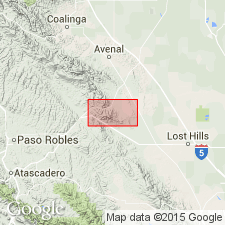
Type locality: Badger Ridge, 1.5 mi west of Cottonwood Pass, Orchard Peak area, Tent Hills quadrangle, Kern Co., southern CA.
[GNC remark (Jan. 20, 2019): subsequent geologists consider Marsh's stratigraphic classification to be of local significance. Most apply Anderson and Pack's (1915) stratigraphic terminology and assign these rocks to the Panoche Formation. See also Panoche.]
Source: US geologic names lexicon (USGS Bull. 1200, p. 190).

- Usage in publication:
-
- Badger Shale
- Modifications:
-
- Overview
- AAPG geologic province:
-
- San Joaquin basin
Summary:
zzzzzArea of report is Avenal Ridge-Reef Ridge area of southern Diablo Range, 200 miles southeast of San Francisco, in Fresno and Kings Counties, west-central California. Eight stratigraphic units ranging from Early to Late Cretaceous are recognized in area, in descending [ascending?] order: Badger Shale, Risco Formation, Johnson Peak Formation, Catskin Formation (new), Lovel Shale (new), Redman [Red Man] Sandstone, Willow Spring Mudstone (new), and Moreno Formation. All rocks are marine of shallow neritic to bathyl depths and consist of thick sequences of mudstone, shale, thin- to thick-bedded concretionary sandstones and conglomerates. Unconformities exist between [Red Man] (Campanian) and Willow Spring (Maastrichtian); [Red Man] and Lovel (Santonian); and Lovel and Catskin (Cenomanian to Coniacian).
Source: US geologic names lexicon (USGS Bull. 1350, p. 130, 443, 832); supplemental information from GNU records (USGS DDS-6; Menlo GNULEX).
For more information, please contact Nancy Stamm, Geologic Names Committee Secretary.
Asterisk (*) indicates published by U.S. Geological Survey authors.
"No current usage" (†) implies that a name has been abandoned or has fallen into disuse. Former usage and, if known, replacement name given in parentheses ( ).
Slash (/) indicates name conflicts with nomenclatural guidelines (CSN, 1933; ACSN, 1961, 1970; NACSN, 1983, 2005, 2021). May be explained within brackets ([ ]).

