The National Geologic Map Database is migrating to a new infrastructure. We apologize for any service disruptions during this process.
|
|---|


- Usage in publication:
-
- Badger Gulch Formation*
- Modifications:
-
- Named
- Dominant lithology:
-
- Mudstone
- AAPG geologic province:
-
- Great Basin province
Summary:
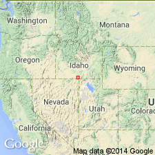
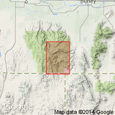
Named for exposures in Badger Gulch, Cassia Co, ID in the Great Basin province. Type measured section is a composite. Graphic section. The lower part is in S1/2 sec 17, T14S, R19E, Pike Mountain and Trapper Creek quads. The upper part is in NW1/4 sec 20, T15S, R20E, Mahogany Butte quad. Is composed of brown-gray to black, very fine grained, thinly laminated lime-mudstone. Is 314 m thick at type. Forms castellated cliffs with jagged spires. Gradationally overlies Third Fork Formation (named); gradationally underlies Trapper Creek Formation (named). Is of early Leonardian, Early Permian age; poorly fossiliferous (radiolarians?, epiplanktic forms); is a marine basin deposit, with water depths in excess of 150 m.
Source: GNU records (USGS DDS-6; Denver GNULEX).
- Usage in publication:
-
- Badger Gulch Formation*
- Modifications:
-
- Areal extent
- Dominant lithology:
-
- Sandstone
- Limestone
- AAPG geologic province:
-
- Great Basin province
Summary:
Mapped in the Little Pigeon Mountains in northeast part of quad and at Lemay Island at southwest part of quad in Elder Co, UT, Great Basin province. Lower contact drawn at base of lowest coarse bioclastic bed above calcareous sandstone of Third Fork Formation. Formation in Little Pigeon Mountains is an incomplete section about 1,075 ft thick. Basal 98 ft has subequal portions of medium-gray limestone, dark-gray to black silty limestone, and brown calcareous sandstone. Rest of formation is black, platy, silty limestone and thick-bedded fossiliferous limestone. Large fusulinids abundant in some bioclastic limestone beds. Correlated with lower part of Pequop? Formation of northern Pilot Range. In earlier mapping rocks assigned to Badger Gulch Formation at Lemay Island were assigned Grandeur Formation and those in the Little Pigeon Mountains were assigned to unit 4 of Grandeur Formation. Of Permian age. Underlies Trapper Creek Formation. [Lithologic description of formation in this quad is different than description of it in Cassia Mountains.]
Source: GNU records (USGS DDS-6; Denver GNULEX).
- Usage in publication:
-
- Badger Gulch Formation*
- Modifications:
-
- Overview
- AAPG geologic province:
-
- Great Basin province
Summary:
Mapped in the central, north, and west parts of quad from Ts13 to 16S, Rs19 to 21E, Cassia Co, ID, Great Basin province, where it has gradational contacts at most localities with the older Third Fork Formation of Early Permian age in the northwest part of quad and with the younger Trapper Creek Formation of Early Permian age. Is about 314 m thick. Forms castellated cliffs that have jagged spires. Of Early Permian age. [See also Stricker 1 quadrangle.]
Source: GNU records (USGS DDS-6; Denver GNULEX).
- Usage in publication:
-
- Badger Gulch Formation*
- Modifications:
-
- Areal extent
- AAPG geologic province:
-
- Great Basin province
Summary:
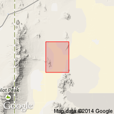
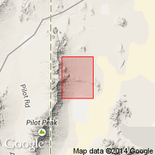
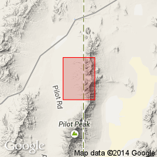
Badger Gulch Formation is geographically extended into the Crater Island NW 7.5' quad, Box Elder Co., UT. Age is Permian.
Source: GNU records (USGS DDS-6; Menlo GNULEX).
- Usage in publication:
-
- Badger Gulch Formation*
- Modifications:
-
- Areal extent
- AAPG geologic province:
-
- Great Basin province
Summary:
Badger Gulch Formation is extended into the Patterson Pass 7.5' quad, Box Elder Co., UT. Age is Permian.
Source: GNU records (USGS DDS-6; Menlo GNULEX).
For more information, please contact Nancy Stamm, Geologic Names Committee Secretary.
Asterisk (*) indicates published by U.S. Geological Survey authors.
"No current usage" (†) implies that a name has been abandoned or has fallen into disuse. Former usage and, if known, replacement name given in parentheses ( ).
Slash (/) indicates name conflicts with nomenclatural guidelines (CSN, 1933; ACSN, 1961, 1970; NACSN, 1983, 2005, 2021). May be explained within brackets ([ ]).