The National Geologic Map Database is migrating to a new infrastructure. We apologize for any service disruptions during this process.
|
|---|


- Usage in publication:
-
- Baca formation*
- Modifications:
-
- Original reference
- Dominant lithology:
-
- Conglomerate
- Sandstone
- Clay
- AAPG geologic province:
-
- Orogrande basin
Summary:
Baca formation. Coarse conglomerate, red and white sandstone, and red clay. Thickness of conglomerate ranges from 80 to 140 feet. Total thickness of formation in Baca Canyon 694 feet. Unconformably overlies all Cretaceous formations in area; underlies Datil formation. Age is Eocene(?).
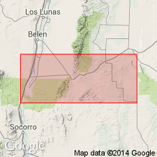
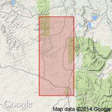
Type section: exposures in Baca Canyon, in secs. 4, 5, 8, and 9, T. 1 N., R. 4 W., north Bear Mountain, Socorro Co., central NM.
Source: US geologic names lexicon (USGS Bull. 1200, p. 187).
- Usage in publication:
-
- Baca Formation
- Modifications:
-
- Overview
- AAPG geologic province:
-
- Orogrande basin
- Basin-and-Range province
Summary:
Is present in discontinuous east-west outcrops near hwys 380 and 60, from Carthage, Socorro Co, NM in the Orogrande basin to the NM state border, Catron Co, NM in the Basin-and-Range province. Extends into adjoining area of AZ. Few vertebrate fossils have been found. Only six occurrences have biostratigraphic significance; these are at or near: Carthage where a titanothere "PALEOSYOPS" was found in the lower part and titanothere MANTEOCERAS [position within formation not stated] identified; Magdalena where an artiodactyl trackway found in lower part; Datil where a PROTOREODON found 37.5 m above the base; and Mariano Mesa where a small mammalian fauna reported. The titanotheres are Bridgerian age. The trackways indicate that part of the Baca is late Eocene or younger. Map shows distribution of Baca in NM; table lists fossil vertebrates; chart shows Baca as unconformably above Mesaverde Group and of Bridgerian, Uintan, Duchesnean, and early Chadronian, or Eocene age. Overlain by Oligocene Spears Formation.
Source: GNU records (USGS DDS-6; Denver GNULEX).
For more information, please contact Nancy Stamm, Geologic Names Committee Secretary.
Asterisk (*) indicates published by U.S. Geological Survey authors.
"No current usage" (†) implies that a name has been abandoned or has fallen into disuse. Former usage and, if known, replacement name given in parentheses ( ).
Slash (/) indicates name conflicts with nomenclatural guidelines (CSN, 1933; ACSN, 1961, 1970; NACSN, 1983, 2005, 2021). May be explained within brackets ([ ]).