


- Usage in publication:
-
- Ayers Landing member
- Modifications:
-
- [Incidental mention]
- AAPG geologic province:
-
- Florida platform
Summary:
Pg. 192 (table 1). Ayers Landing member of Caloosahatchee marl. Table shows Ayers Landing as uppermost member of Caloosahatchee. Overlies Bee Branch [limestone] member (new); underlies Okaldakoochee marl member (new) of Fort Thompson formation. [Age is Pleistocene.]
Source: US geologic names lexicon (USGS Bull. 1200, p. 183).
- Usage in publication:
-
- Ayers Landing member
- Modifications:
-
- Principal reference
- AAPG geologic province:
-
- South Florida province
- Florida platform
Summary:
Pg. 136 (fig. 4), 144; Illinois Acad. Sci. Trans., v. 50, p. 192 (table 1), 1957. Ayers Landing member of Caloosahatchee marl. Shell bed that conformably overlies Bee Branch member (new) in many localities between La Belle and Fort Denaud. At many localities, unit is very arenaceous, and calcium earbonate content is mainly in form of mollusk shells. Thick beds are generally only slightly consolidated. Sands are usually tan to yellow brown, and fossils nearly white. At some localities, unit is better consolidated, much more calcareous, concretionary, and fine grained. Both facies are massive and generally without stratification. Thickness 2.5 to 8.5 feet; unit is discontinuous, being absent or greatly thinned over the arches. Uppermost member of Caloosahatchee. Underlies Okaldakoochee marl member (new) of Fort Thompson formation. [Age is Pleistocene.]
Source: US geologic names lexicon (USGS Bull. 1200, p. 183).

- Usage in publication:
-
- Ayers Landing member
- Modifications:
-
- Principal reference
- AAPG geologic province:
-
- Florida platform
Summary:
Pg. 192, 193, 194. Ayers Landing member of the Caloosahatchee marl. Thickness 3.1 feet at type locality, herein stated. Here, overlies Bee Branch member and underlies Fort Thompson formation(?). Includes shell bell, marine limestone, and Panope faunizone. Entire upper section of Caloosahatchee, which is called Ayers Landing marl by DuBar (1958), was included in Fort Thompson formation by Parker and Cooke, 1944 (Florida Geol. Survey Bull. 27) and Parker and others, 1955 (USGS Water-Supply Paper 1255) and considered to be Pleistocene in age.
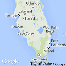
Type locality: DuBar's section A35, in [SW/4 NW/4 sec. 1], T. 43 S., R. 28 E., Hendry Co., southern FL. Section measured on right bank of Caloosahatchee River about 90 yds upstream from Turtle Creek, in vicinity of Ayers Landing.
Source: US geologic names lexicon (USGS Bull. 1200, p. 183).
- Usage in publication:
-
- Ayers Landing Member
- Modifications:
-
- Age modified
- AAPG geologic province:
-
- Florida platform
Summary:
Ayers Landing Member of Caloosahatchee Formation. Age is early or middle Pleistocene, deposition having occurred more than 400,000 years ago.
Source: GNU records (USGS DDS-6; Reston GNULEX).
For more information, please contact Nancy Stamm, Geologic Names Committee Secretary.
Asterisk (*) indicates published by U.S. Geological Survey authors.
"No current usage" (†) implies that a name has been abandoned or has fallen into disuse. Former usage and, if known, replacement name given in parentheses ( ).
Slash (/) indicates name conflicts with nomenclatural guidelines (CSN, 1933; ACSN, 1961, 1970; NACSN, 1983, 2005, 2021). May be explained within brackets ([ ]).