- Usage in publication:
-
- Avoca limestone bed
- Modifications:
-
- Original reference
- Dominant lithology:
-
- Limestone
- AAPG geologic province:
-
- Nemaha anticline
Summary:
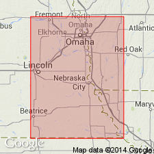
Pg. 44, 45, 47. Avoca limestone bed of Lecompton limestone member of Shawnee formation. Top unit in Lecompton limestone. Dense bluish limestone in 2 or 3 beds, weathers yellowish-brown. Thickness 2 to 9 feet in southeastern Nebraska; 1+ feet in northwestern Missouri and northeastern Kansas. Overlies King Hill shale. Age is Late Pennsylvanian (Missouri age). Report includes cross sections, measured sections, geologic maps, stratigraphic tables.
Named from exposure in South Fork Weeping Water Creek about 3 mi east of Avoca, Otoe Co., southeastern NE.
Source: US geologic names lexicon (USGS Bull. 896, p. 97); GNC KS-NE Pennsylvanian Corr. Chart, sheet 1, Oct. 1936; supplemental information from GNU records (USGS DDS-6; Denver GNULEX).
- Usage in publication:
-
- Avoca limestone member
- Modifications:
-
- Overview
Summary:
Pg. 2035 (fig. 5). Avoca limestone member of Lecompton formation; overlies King Hill shale member; underlies Tecumseh formation. This is classification agreed upon by State Geological Surveys of Iowa, Kansas, Missouri, Nebraska, and Oklahoma, May 1947. Age is Late Pennsylvanian (Virgilian).
See also, R.C. Moore, 1949, Kansas Geol. Survey Bull. 83, p. 126 (fig. 22), 155; F.C. Greene and W.V. Searight, 1949, Missouri Geol. Survey and Water Res. Rept. Inv. 11, p. 17.
Source: US geologic names lexicon (USGS Bull. 1200, p. 179).
- Usage in publication:
-
- Avoca limestone member
- Modifications:
-
- Principal reference
Summary:
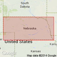
Pg. 23. Avoca limestone member of of Lecompton Limestone. In Nebraska, underlies Kenosha shale member of Tecumseh formation. Thickness 1 to 4 feet or more in Iowa, Nebraska, and northwestern Missouri; becomes CRYPTOZOON-bearing limestone and thicker in southern Kansas and Oklahoma. Type locality stated. Age is Late Pennsylvanian (Virgilian).
Type locality: on South Branch Weeping Water Creek, about 3 mi east of Avoca, Otoe Co., southeastern NE.
Source: US geologic names lexicon (USGS Bull. 1200, p. 179).
- Usage in publication:
-
- Avoca limestone member
- Modifications:
-
- Areal extent
- AAPG geologic province:
-
- Forest City basin
Summary:
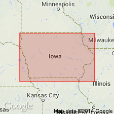
Pg. 19, fig. 5. Avoca limestone member of Lecompton limestone. Consists of two thin fossiliferous dark- to bluish-gray limestones separated by dark-gray fossiliferous shale. Thickness about 2 feet in western Mills County; not differentiated in northeastern Adair County. Overlies King Hill shale member; underlies Kenosha shale member of Tecumseh shale. Age is Late Pennsylvanian (Virgilian).
Source: US geologic names lexicon (USGS Bull. 1200, p. 179-180).
- Usage in publication:
-
- Avoca Limestone Member
- Modifications:
-
- Overview
Summary:
(Paleozoic Era; Pennsylvanian System by J.M Jewett, H.G. O'Connor, and D.E. Zeller, p. 37.) Avoca Limestone Member of Lecompton Limestone of Shawnee Group. In Kansas, a dark bluish-gray, somewhat earthy limestone occurring in one or more beds. Large fusulinids are the most common fossils. In southeastern Kansas CRYPTOZOON-bearing limestone is characteristic of the member. Algal-molluscan limestone beds occur at the top of the Avoca in some outcrops. The thickness ranges from about 1 to 20 feet. Occurs above King Hill Shale Member of Lecompton Limestone and below Tecumseh Shale. Age is Pennsylvanian (Virgilian).
Source: Publication.
- Usage in publication:
-
- Avoca Limestone Member
- Modifications:
-
- Overview
- AAPG geologic province:
-
- Forest City basin
Summary:
Pg. 123 (fig. 36), 124-125. Avoca Limestone Member of Lecompton Formation of Shawnee Group. Consists of two or more beds of argillaceous limestones separated by shaly partings. Thickness 3 to 5 feet in southern Holt County and is of comparable thickness elsewhere in northwestern Missouri. Occurs above King Hill Shale Member of Lecompton Formation and below Tecumseh Shale, both of Shawnee Group. Fossils (fusulinids). Age is Late Pennsylvanian (Virgilian).
Source: Publication.
For more information, please contact Nancy Stamm, Geologic Names Committee Secretary.
Asterisk (*) indicates published by U.S. Geological Survey authors.
"No current usage" (†) implies that a name has been abandoned or has fallen into disuse. Former usage and, if known, replacement name given in parentheses ( ).
Slash (/) indicates name conflicts with nomenclatural guidelines (CSN, 1933; ACSN, 1961, 1970; NACSN, 1983, 2005, 2021). May be explained within brackets ([ ]).

