The National Geologic Map Database is migrating to a new infrastructure. We apologize for any service disruptions during this process.
|
|---|


- Usage in publication:
-
- Avenal sandstone
- Modifications:
-
- Original reference
- Dominant lithology:
-
- Sandstone
- AAPG geologic province:
-
- San Joaquin basin
Summary:
Pg. 164-168. Avenal sandstone. A great thickness of sandstone exposed in canyon of Canoas Creek, with a thin basal bed of conglomerate, 6 to 10 feet thick, resting on Lower Cretaceous shales. Upper 400 feet consists of very fossiliferous concretionary sandstones, below which occur thin-bedded sandstone. The Avenal wells at Tar Springs are drilled to penetrate these sands, which are exposed at Tar Springs on east and at Sulphur Springs on Zapato Chino Creek to west. Underlies Kreyenhagen shale. Age is Eocene, based on included invertebrate fossils. Shown on cross section of Tar Springs.
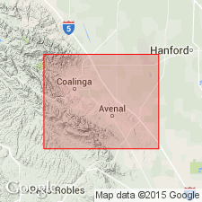
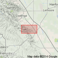
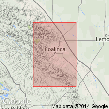
[Named from Avenal wells at Tar Springs, in E/2 E/2 sec. 18, T. 23 S., R. 17 E., Diablo Range, Garza 7.5-min quadrangle, King Co., southern CA.]
Source: US geologic names lexicon (USGS Bull. 896, p. 95); GNU records (USGS DDS-6; Menlo GNULEX).
- Usage in publication:
-
- Avenal sandstone
- Modifications:
-
- Not used
- AAPG geologic province:
-
- San Joaquin basin
Summary:
Rocks of Eocene age in Big Tar Canyon [of Anderson (1905)] are here referred to as sandstone beds of Tejon formation.
Source: GNU records (USGS DDS-6; Menlo GNULEX).
- Usage in publication:
-
- Avenal sandstone
- Modifications:
-
- Not used
- AAPG geologic province:
-
- San Joaquin basin
Summary:
Pg. 1321-1336. The 500 feet of sandstone underlying Kreyenhagen shale in canyon of Canoas Creek is Domengine sandstone, of [late] Eocene age. The type locality of Domengine is north of Coalinga, Diablo Range, southern California.
Source: US geologic names lexicon (USGS Bull. 896, p. 95).
- Usage in publication:
-
- Avenal sandstone*
- Modifications:
-
- Adopted
- AAPG geologic province:
-
- San Joaquin basin
Summary:
Avenal sandstone of Anderson (1905), also called sandstone beds of Tejon formation by Arnold and Anderson (1908) and Domengine sandstone by Vokes (1939), is adopted for exposures on Reef Ridge near Big Tar Canyon. Contains mollusks of middle Eocene age. McAdams sand in subsurface of Kettleman Hills includes equivalent of Avenal sandstone and perhaps greater time interval.
Source: GNU records (USGS DDS-6; Menlo GNULEX).
- Usage in publication:
-
- Avenal sandstone
- Modifications:
-
- Areal extent
- Biostratigraphic dating
- AAPG geologic province:
-
- San Joaquin basin
Cushman, J.A., and Siegfus, S.S., 1942, Foraminifera from the type area of the Kreyenhagen shale of California: San Diego Society of Natural History Transactions, v. 9, no. 34, p. 385-426.
Summary:
Pg. 390, 397-398. Avenal sandstone. Listed as underlying Canoas siltstone member of Kreyenhagen shale at Garza Creek, Kings County, southern California. Consists of: brownish gray, rather thickly bedded, fine- to medium-grained sand; SPIROGLYPHUS reef sandstone; and light-gray, fine-grained, friable sandstone. Fossils (notably gastropod SPIROGLYPUS? TEJONENSIS). In McLure Valley contains Domengine microfauna. Age is middle Eocene (assigned to California Domengine stage of Clark and Vokes, 1936, GSA Bull., v. 47, no. 6, p. 851-878).
[Typographical error (US geologic names lexicon, USGS Bull. 1200, p. 177): Canoas misspelled Canos.]
Source: Publication; US geologic names lexicon (USGS Bull. 1200, p. 177).
- Usage in publication:
-
- Avenal sandstone*
- Modifications:
-
- Mapped
- Biostratigraphic dating
- Dominant lithology:
-
- Sandstone
- AAPG geologic province:
-
- San Joaquin basin
Summary:
Pg. 86 (fig. 12), 87 (fig. 13), 89-94, 111, tbl. 1, pls. 9 (geol. map), 10, 14. Avenal sandstone. Massive sandstone with fossiliferous lenses and thin conglomerate layers; basal part is pebbly and cross-bedded. Thickness up to 400 feet. Underlies Kreyenhagen shale, and in places, underlies Temblor sandstone. Overlies Panoche formation; contact is an unconformity. Rocks previously assigned to Domengine and Tejon formations by some geologists. Fossils [listed], notably gastropods TURRITELLA cf. T. BUWALDANA Dickerson, SPIROGLYPHUS? TEJONENSIS Arnold. Age is Eocene.
Source: Publication.
- Usage in publication:
-
- Avenal sandstone
- Modifications:
-
- Areal extent
- AAPG geologic province:
-
- San Joaquin basin
Summary:
Pg. 46, 50-51. Avenal sandstone. In Tent Hills area, south of Reef Ridge area, about 18 miles southwest of Avenal, Kern County, southern California, overlies Acebedo formation (new). Footnote, page 46, refers to Acebedo as member of Lodo formation. Age is Eocene.
Source: US geologic names lexicon (USGS Bull. 1200, p. 177, Acebedo entry p. 15).
- Usage in publication:
-
- Avenal Sandstone*
- Modifications:
-
- Principal reference
- AAPG geologic province:
-
- San Joaquin basin
Summary:
Type section is in Big Tar Canyon, where unit unconformably overlies Panoche Formation and underlies Canoas Siltstone Member of Kreyenhagen Shale. Fauna is discussed. Correlated with middle Eocene type Domengine Sandstone of Coalinga area. Age is considered middle Eocene.
Type section: in Big Tar Canyon [in sec. 18, T. 23 S., R. 17 E., Garza 7.5-min quadrangle, King Co., CA]
Source: Modified from GNU records (USGS DDS-6; Menlo GNULEX).
- Usage in publication:
-
- Avenal Sandstone*
- Modifications:
-
- Areal extent
- Revised
- AAPG geologic province:
-
- San Joaquin basin
Summary:
Avenal Sandstone. Geographically extended into areas west, south, and southeast of McLure Valley [now Sunflower Valley], southern California, because of similar lithology and probable stratigraphic position. In Diablo Range, west of [Sunflower Valley], Avenal Sandstone includes rocks called Acebedo Sandstone by Dickinson (1963). In Devils Den area, includes rocks called Mabury Sandstone by Van Couvering and Allen (1943). In Temblor Range, between Media Agua and Carneros Creeks, Avenal includes middle part of Lodo Formation of Mallory (1959). Avenal Sandstone, as herein described, is presumably of Domengine molluscan age (Penutian and Ulatisian Stages); age is early and middle Eocene. Local names Acebedo and Mabury not formally adopted by the USGS.
Source: Modified from GNU records (USGS DDS-6; Menlo GNULEX); Changes in stratigraphic nomenclature, 1973 (USGS Bull. 1395-A, p. A4-A5).
- Usage in publication:
-
- Avenal Sandstone
- Modifications:
-
- Areal extent
- Dominant lithology:
-
- Sandstone
- AAPG geologic province:
-
- San Joaquin basin
Kappeler, K.A., Squires, R.L., and Fritsche, A.E., 1984, Transgressive marginal-marine deposits of the Avenal Sandstone, Reef Ridge, central California: Society of Economic Paleontologists and Mineralogists, Pacific Section, annual meeting, San Diego, CA, April 18-21, 1984, book 37, p. 9-27.
Summary:
Avenal Sandstone. Ninety-five percent of formation is a thick- to thin-bedded, fossiliferous, fine- to coarse-grained sandstone. In places basal part is a pebble conglomerate up to 7 m thick. Maximum thickness of formation 130 m. Rests unconformably on Upper Cretaceous Panoche Formation. Gradationally underlies lower middle Eocene Kreyenhagen Formation. To southeast is overlapped by middle Miocene McLure Shale Member of Monterey Formation and to northwest is overlapped by lower Miocene Temblor Formation. Locally, active oil seeps and tar springs occur near top of formation. In Kettleman oil field, 10 km east of study area, the Avenal is an oil-producing horizon. Megafossils identified by R.L. Squires [listed on p. 17 (table 2); plotted on msrd. strat. secs. (p. 14-15, fig. 6) and geol. map (p. 11, fig. 3); California State Univ.-Northridge megafossil loc. registry given on p. 24]. Age is late early to early middle Eocene (Ypresian to Lutetian), based on fossils.
[On correlation chart of fossil zonations (p. 18, fig. 7), the Avenal lies within: "Domengine" provincial molluscan stage (Clark and Vokes, 1938; Givens, 1974; Saul, 1983); Ulatisian benthic foraminiferal stage of Mallory (1959); benthic foraminiferal zones B-1 and B-1A of Laiming (1940a, 1940b, 1943); Paleogene planktonic foraminiferal zones P8 to P10 of Berggren and others (in press); calcareous nannoplankton zones NP13 to NP14 of Martini (1971) and calcareous nannoplankton zones CP11 to CP12b of Bukry and Okada (1980). The Avenal is about 54.5 to 50 Ma.]
Measured stratigraphic sections in Reef Ridge and Kreyenhagen Hills areas, southern CA; [additional locality information from USGS historical topographic map collection TopoView, accessed on my dad's 78th birthday 2019]:
(1) in NE/4 sec. 10, T. 23 S., R. 17 E., [Big Tar Creek, Kettleman Plain 7.5-min quadrangle, Kings Co.];
(2) in N/2 sec. 10, T. 23 S., R. 16 E., [Garza Creek area, Garza Peak 7.5-min quadrangle, Kings Co.];
(3) in SE/4 sec. 32, T. 22 S., R. 16 E., [Canoas Creek, The Dark Hole 7.5-min quadrangle, Fresno Co.];
(4) in NE/4 sec. 31, T. 22 S., R. 16 E., Reese Canyon, The Dark Hole 7.5-min quadrangle, [Fresno Co.];
(5) in NE/4 sec. 35, T. 22 S., R. 15 E., [Arroyo Pinoso, The Dark Hole 7.5-min quadrangle, Fresno Co.]; and
(6) in NE/4 sec. 21, T. 22 S., R. 15 E., [Zapato Chino Canyon, Kreyenhagen Hills 7.5-min quadrangle, Fresno Co.].
Source: Publication.
- Usage in publication:
-
- Avenal Sandstone
- Modifications:
-
- Paleomagnetics
- AAPG geologic province:
-
- San Joaquin basin
Prothero, D.R., 2001, Magnetic stratigraphy of the lower-middle Eocene Domengine, Avenal, and Yokut Sandstones, western San Joaquin basin, Fresno and Kings Counties, California: Society of Economic Paleontologists and Mineralogists, Pacific Section, book 91, p. 45-55.
Summary:
Pg. 46-47, 49-50, 51 (fig. 5), 52 (fig. 6), 55 (table). Avenal Sandstone. Samples indicate the Avenal is entirely of reversed magnetic polarity and is correlative with magnetic Chron C21r (49 to 47.9 Ma). Age is earliest middle Eocene.
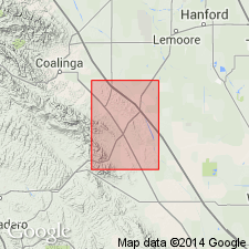
Samples collected from Garza Reef Ridge, in N/2 sec. 10, T. 23 S., R. 16 E., Garza Peak 7.5-min quadrangle, Kings Co., CA. Stratigraphy after Kappeler and others, 1984, fig. 6.
Source: Publication.
For more information, please contact Nancy Stamm, Geologic Names Committee Secretary.
Asterisk (*) indicates published by U.S. Geological Survey authors.
"No current usage" (†) implies that a name has been abandoned or has fallen into disuse. Former usage and, if known, replacement name given in parentheses ( ).
Slash (/) indicates name conflicts with nomenclatural guidelines (CSN, 1933; ACSN, 1961, 1970; NACSN, 1983, 2005, 2021). May be explained within brackets ([ ]).