The National Geologic Map Database is migrating to a new infrastructure. We apologize for any service disruptions during this process.
|
|---|


- Usage in publication:
-
- Avant limestone lentil
- Modifications:
-
- Original reference
- Dominant lithology:
-
- Limestone
- AAPG geologic province:
-
- Chautauqua platform
Summary:
Pg. 31, 37. Avant limestone lentil. Bluish semicrystalline limestone, often thin-bedded, from a few feet to 40 feet thick. Stratigraphically about 85 feet above Dewey limestone along 96th meridian south of Bartlesville. Included in Copan member of Wann formation in northern area and in Ramona formation in southern area. Age is Pennsylvanian.
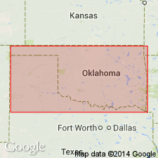
Named from Avant, Osage Co., northeastern OK.
Source: US geologic names lexicon (USGS Bull. 896, p. 95).

- Usage in publication:
-
- Avant limestone member*
- Modifications:
-
- Overview
- AAPG geologic province:
-
- Chautauqua platform
Summary:
Avant limestone member of Ochelata formation (adopted by the USGS). Present in central northern, northeastern, and northern central Oklahoma. In northern Oklahoma Avant limestone is now [ca. 1938] treated as a member of Ochelata formation; in Bristow quadrangle is treated as a member of Copan formation. Age is Pennsylvanian.
Source: US geologic names lexicon (USGS Bull. 896, p. 95).
- Usage in publication:
-
- Avant limestone member
- Modifications:
-
- Revised
- AAPG geologic province:
-
- Chautauqua platform
Summary:
Pg. 40, 43. Avant limestone member of Iola formation. Reallocated. Comprises upper member of Iola formation. Underlies Lane-Vilas shale; overlies Muncie Creek shale member, Iola formation. Equivalent to Raytown in Kansas. Age is Late Pennsylvanian (Missourian).
Source: US geologic names lexicon (USGS Bull. 1200, p. 176-177).
- Usage in publication:
-
- Avant limestone member
- Modifications:
-
- Principal reference
- AAPG geologic province:
-
- Chautauqua platform
Summary:
Pg. 82-83, pl. 11. Avant limestone member of Iola limestone of Ochelata group. Described as limestone, sandy limestone, calcareous shale, and clay shale. Locally interfingers with underlying Muncie Creek shale member. Underlies Wann formation. Age is Late Pennsylvanian (Missourian). Type locality designated.
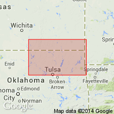
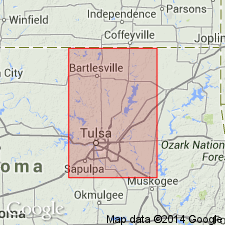
Type locality: in T. 23 N. [R. 12 and 13 E.], Osage Co., northeastern OK.
Source: US geologic names lexicon (USGS Bull. 1200, p. 176-177).
- Usage in publication:
-
- Avant limestone member
- Modifications:
-
- Areal extent
- AAPG geologic province:
-
- Chautauqua platform
Summary:
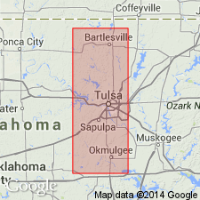
Pg. 32-33. Avant limestone member of Iola limestone of Ochelata group. Avant is 55 feet thick at type locality. Only upper part of this thick phase extends across Tulsa County. There are sandy limestone beds in sec. 4, T. 20 N., R. 10 E., that occupy same stratigraphic position as basal bed of Avant at Avant and they extend across Tulsa County. The two sets of calcareous beds are called colloquially upper and lower Avant and are thought to mark limits of Avant member, which contains more shale than limestone at south side of western Tulsa County. In Creek County, a prominent escarpment that extends from north line to south side of sec. 20, T. 14 N., R. 9 E., is capped by sandy limestone that represents Avant limestone member, but upper limit of member cannot be determined. This limestone grades into basal part of massive sandstone, Tiger Creek sandstone of Fath (1925), that caps the escarpment southward.
Source: US geologic names lexicon (USGS Bull. 1200, p. 176-177).
For more information, please contact Nancy Stamm, Geologic Names Committee Secretary.
Asterisk (*) indicates published by U.S. Geological Survey authors.
"No current usage" (†) implies that a name has been abandoned or has fallen into disuse. Former usage and, if known, replacement name given in parentheses ( ).
Slash (/) indicates name conflicts with nomenclatural guidelines (CSN, 1933; ACSN, 1961, 1970; NACSN, 1983, 2005, 2021). May be explained within brackets ([ ]).