

- Usage in publication:
-
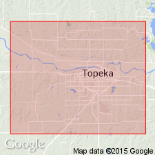
- Auburn shale
- Modifications:
-
- Original reference
- Dominant lithology:
-
- Shale
- AAPG geologic province:
-
- Forest City basin
Summary:
Auburn shale. Fossiliferous olive-colored shale, 8 to 20 feet thick, included in Upper Coal Measures of Shawnee County. [From statement on p. 28 appears to underlie Elmont limestone and overlie Wakarusa limestone.]
Source: US geologic names lexicon (USGS Bull. 896, p. 91).

- Usage in publication:
-
- Auburn shale bed
- Modifications:
-
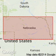
- Areal extent
- Dominant lithology:
-
- Shale
- AAPG geologic province:
-
- Forest City basin
Summary:
Pg. 66. Auburn shale bed of Humphrey shale member of Wabaunsee formation. Is 20 feet thick in Nebraska. It overlies Wakarusa limestone and underlies Emporia limestone. Is top bed of Humphrey shale member of Wabaunsee formation. The name was free at time it was used by Beede and should be retained for this unit. Age is Late Pennsylvanian (Missouri age). Report includes cross sections, measured sections, geologic maps, stratigraphic tables.
Source: US geologic names lexicon (USGS Bull. 896, p. 91); GNC KS-NE Pennsylvanian Corr. Chart, sheet 1, Oct. 1936; supplemental information from GNU records (USGS DDS-6; Denver GNULEX).

- Usage in publication:
-
- Auburn shale formation
- Modifications:
-
- Overview
- Dominant lithology:
-
- Shale
- AAPG geologic province:
-
- Forest City basin
- Nemaha anticline
Summary:
Pg. 10. Auburn shale formation of Wabaunsee group. Gray, red, and bluish-gray zones, quite calcareous and fossiliferous near top, 18 to 30 feet thick. Underlies Reading limestone (older than Elmont limestone) and overlies Wakarusa limestone formation. Age is Late Pennsylvanian (Virgil).
Source: US geologic names lexicon (USGS Bull. 896, p. 91); GNC KS-NE Pennsylvanian Corr. Chart, sheet 2, Oct. 1936.

- Usage in publication:
-
- Auburn shale
- Modifications:
-
- Principal reference
- Dominant lithology:
-
- Shale
- AAPG geologic province:
-
- Forest City basin
Summary:
Auburn shale formation of Wabaunsee group. Condra (1927) has used Auburn shale for a lower bed than Beede's Wakarusa limestone. Because greater importance is attached to usage in recent literature than to priority in the case of a term that has been unused except in original rather obscure paper, we follow Condra's placement of Auburn shale. Thickness 20 to 70 feet. Continuous from southeast Nebraska across Kansas into Oklahoma. Age is Late Pennsylvanian (Virgil).
Type locality not designated, but undoubtably it is in vicinity of Auburn, Shawnee Co., KS. Good exposures along Wakarusa Creek near NE corner sec. 26, T. 13 S., R. 14 E., southwest of Auburn.
Source: US geologic names lexicon (USGS Bull. 896, p. 91); GNC KS-NE Pennsylvanian Corr. Chart, sheet 2, Oct. 1936.
- Usage in publication:
-
- Auburn shale
- Modifications:
-
- Areal extent
- Dominant lithology:
-
- Shale
- AAPG geologic province:
-
- Forest City basin
Summary:
Auburn shale. Geographically extended into Iowa and Missouri.
Source: US geologic names lexicon (USGS Bull. 1200, p. 170).

- Usage in publication:
-
- Auburn shale
- Modifications:
-
- Overview
- Dominant lithology:
-
- Shale
- AAPG geologic province:
-
- Forest City basin
Summary:
Pg. 56 (fig. 21), 60, 70 (fig. 25). Auburn shale. Somewhat complex and variable unit composed chiefly of shale containing minor amounts of sandstone and limestone, part of which is chalky. Contains two or more local coal beds. Near Kansas River, contains lenses of cross-bedded limestone and conglomerate and coquinoid masses of molluscan and algal remains as much as several feet thick; locally contains dark shale-bearing ostracodes and pelecypods. Thickness in Kansas ranges from about 20 to 70 feet. Underlies Reading limestone; overlies Wakarusa limestone.
Source: US geologic names lexicon (USGS Bull. 1200, p. 170).

- Usage in publication:
-
- Auburn shale*
- Modifications:
-
- Revised
Summary:
Pg. 2274 (fig. 1). Auburn shale of Wabaunsee group. Wabaunsee group redefined. Auburn shale overlies Wakarusa limestone member of Bern limestone (new); underlies Reading limestone member of Emporia limestone. Age is Late Pennsylvanian (Virgilian).
Source: US geologic names lexicon (USGS Bull. 1200, p. 170-171).
- Usage in publication:
-
- Auburn shale
- Modifications:
-
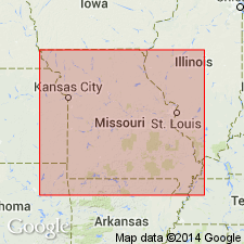
- Areal extent
- Dominant lithology:
-
- Sandstone
- Shale
- AAPG geologic province:
-
- Forest City basin
Summary:
Auburn shale. Term is applied to sandstone-shale sequence between Wakarusa and Reading limestones. Auburn is continuous from southeastern Nebraska across Kansas into northern Oklahoma, where it has been traced into southern Lincoln County. South of Lincoln County, limiting limestones pinch out, and Auburn cannot be distinguished from adjacent shales. Thickness 65 to 70 feet in Pawnee County. Overlies Wakarusa limestone; underlies Reading limestone member of Emporia limestone.
Source: US geologic names lexicon (USGS Bull. 1200, p. 170-171).

- Usage in publication:
-
- Auburn shale
- Modifications:
-
- Areal extent
- Dominant lithology:
-
- Shale
- AAPG geologic province:
-
- Forest City basin
Summary:
Auburn shale of Wabaunsee group in Iowa. Upper part of greenish-gray clayey shale; in center shale is deep red to maroon, silty, and micaceous; this middle part commonly contains leaf prints and carbonaceous films; lower part is silty, dark gray to black, and locally carbonaceous. Thickness about 35 feet. Underlies Reading limestone; overlies Wakarusa limestone. Age is Late Pennsylvanian (Virgilian).
Source: US geologic names lexicon (USGS Bull. 1200, p. 171).

- Usage in publication:
-
- Auburn Shale
- Modifications:
-
- Overview
Summary:
(Paleozoic Era; Pennsylvanian System by J.M Jewett, H.G. O'Connor, and D.E. Zeller, p. 41.) Auburn Shale of Nemaha subgroup [informal] of Wabaunsee Group. The Auburn Shale is a complex and variable formation composed chiefly of shale, minor amounts of sandstone, and limestone, some of which is chalky. Near the Kansas River the middle part of the Auburn is a cross-bedded, conglomeratic limestone about 5 feet thick containing fossils (molluscan and algal remains). In places there are dark-gray shale beds containing numerous ostracodes and pelecypods. Two or more coal beds occur locally in the Auburn. The thickness of the formation in Kansas ranges from about 20 to 70 feet. Occurs above Wakarusa Limestone Member of Bern Limestone and below Reading Limestone Member of Emporia Limestone. Age is Late Pennsylvanian (Virgilian).
["Subgroup" not recognized as a formal stratigraphic rank term (CSN, 1933; ACSN, 1961, 1970; NACSN, 1983, 2005, 2021). Considered informal and should not be capitalized.]
Source: Publication.
- Usage in publication:
-
- Auburn Shale
- Modifications:
-
- Overview
- AAPG geologic province:
-
- Forest City basin
Summary:
Pg. 127 (fig. 37), 129. Auburn Shale of Nemaha subgroup [informal] of Wabaunsee Group. Recognized in northwestern Missouri. Mostly micaceous, silty, gray shale; contains a persistent layer of silty, maroon clay in upper part. A bed of calcareous siltstone and fine sandstone is present below the maroon clay at some localities. In its outcrop area, is approximately 30 feet thick. Overlies Wakarusa Limestone Member of Bern Formation; underlies Reading Limestone Member of Emporia Formation (all of Nemaha subgroup [informal] of Wabaunsee Group). Age is Pennsylvanian (Virgilian).
["Subgroup" not recognized as a formal stratigraphic rank term (CSN, 1933; ACSN, 1961, 1970; NACSN, 1983, 2005, 2021). Considered informal and should not be capitalized.]
Source: Publication.
For more information, please contact Nancy Stamm, Geologic Names Committee Secretary.
Asterisk (*) indicates published by U.S. Geological Survey authors.
"No current usage" (†) implies that a name has been abandoned or has fallen into disuse. Former usage and, if known, replacement name given in parentheses ( ).
Slash (/) indicates name conflicts with nomenclatural guidelines (CSN, 1933; ACSN, 1961, 1970; NACSN, 1983, 2005, 2021). May be explained within brackets ([ ]).